


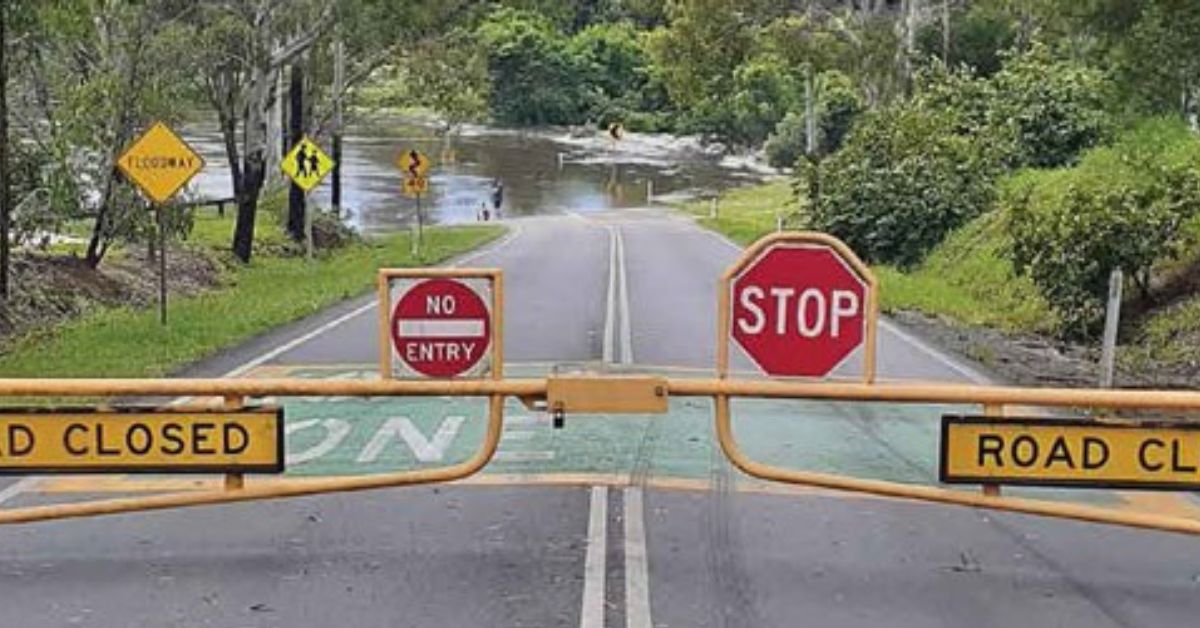
Seqwater says North Pine Dam was 53.7 per cent full at 3.46pm on Friday, 23 October, as flood releases continued after Thursday’s heavy rain across Brisbane and Moreton Bay. The latest public update also says releases began at 11pm on Thursday and that Youngs Crossing is closed.
That is the clearest verified local finding. The dam is releasing water. Youngs Crossing is shut. Beyond that, the public record does not support a wider claim about flooding across every downstream suburb.
Youngs Crossing is the confirmed downstream impact
Seqwater says the flood releases, together with river and creek flows downstream of the dam, inundated Youngs Crossing. The agency also says a controlled release from a gated dam will not necessarily cause downstream flooding.


That distinction matters for Petrie, Murrumba Downs and other communities downstream of the North Pine River. A release is a managed operational response. It is not, by itself, proof of wider flood damage.
North Pine Dam sits across the North Pine River near Petrie. Seqwater says its five steel gates allow controlled releases during heavy rain.
What the public pages do not show
Seqwater’s release notice directs people to local council and Queensland Traffic for road and crossing closures, and to the Bureau of Meteorology for weather warnings and river heights. The Bureau’s Pine/Caboolture brochure says it does not currently provide a flood warning service for the Pine River or Caboolture River.
That leaves a real information gap for local readers. The public pages checked do not publish a separate inflow figure. They also do not provide a full official gauge table for every downstream suburb.
So the safest reading is narrow. Storage is near the reduced operating level. Releases are underway. Youngs Crossing is closed. Anything broader needs a fresh official check.
Downstream readers still need local checks
For people in Petrie, Murrumba Downs and nearby suburbs, the sensible next step is to keep checking Seqwater, council road notices, Queensland Traffic and the Bureau of Meteorology.
That is the only reliable way to track whether the situation changes downstream. It is also the best guard against assuming too much from a single release notice.
Published 23-October-2026


CLICK ANY LOGO TO SEE PUBLICATION