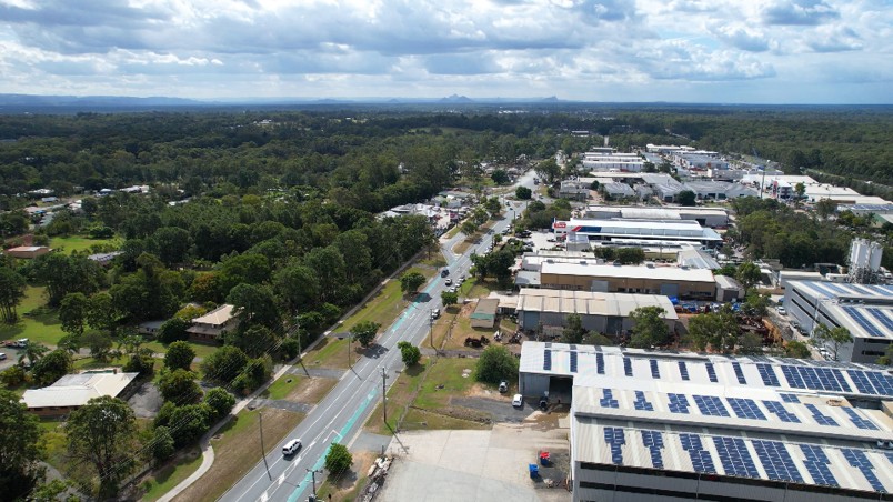
North Lakes’ Boundary Road on Council’s Wildlife Watch List as Kangaroo Camera Is Set Up

Boundary Road in North Lakes is one of 11 roads that Moreton Bay officials have asked drivers to watch for wildlife, while the officials also set up a camera to study kangaroos near roads where they are commonly struck.


kangaroo
Photo Credit: Supplied

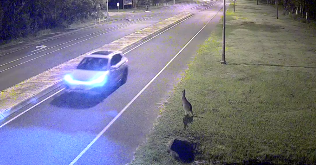
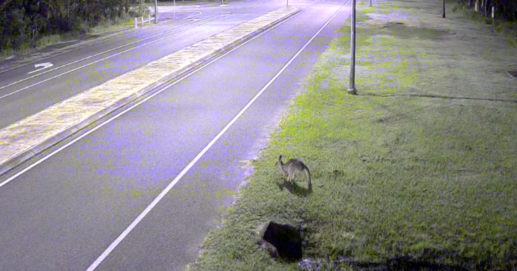
Council announced the camera on World Kangaroo Day, Saturday 24 October. Its media release says the motion-activated mobile camera is being set up around roads where kangaroos are often hit, with the footage analysed for ways to prevent collisions and to see how kangaroos react around vehicles. It does not say where the camera is, name any kangaroo hotspots or give suburb-level collision numbers, so it is not confirmed that North Lakes is involved.

Boundary Road’s place on the list comes from a council appeal to drivers in June, as reported by Moreton Daily. That report named the road but not the animals at risk there, so it does not show kangaroos are a particular problem on it. In the same report, Mayor Peter Flannery described dawn and dusk as “peak feeding times for koalas, kangaroos and other animals”.

“It’s important our wildlife can move around safely across roads and community areas,” Mayor Peter Flannery said in the council’s written release, which also urges drivers to take care around dawn and dusk and report injured wildlife as soon as possible.

North Lakes and its neighbours already appear in council’s wildlife road records. A 2019 council release listed wildlife stencils on Diamond Jubilee Way at North Lakes, and Maryvale Road at Mango Hill and Alma Road at Dakabin were among 12 sites for a 10-day warning sign trial in 2022. In Griffin, council has installed two escape hatches on Henry Road and two on Dohles Rocks Road. Those hatches are one-way exits designed for koalas, not kangaroos. Council’s trial of larger kangaroo and wallaby hatches is on Bribie Island.

The release also lists 150 LED vehicle-activated signs, 48 fauna underpasses and more than 40 fauna exclusion fencing locations. Those are city-wide totals, not figures for these suburbs. Council reported 130 of the signs in July 2025, so the count is growing.

Growth is part of council’s framing. Last year the mayor tied its wildlife road program to rising traffic from a “booming population”, and council says it counts 8.8 million vehicle movements a week in its wildlife zones. Nothing published shows whether that growth has changed where kangaroos cross in North Lakes, Mango Hill, Griffin or Dakabin, and no kangaroo-specific collision figures are available for those suburbs. An earlier Moreton Daily report quoted a local environment group member who spotted a young kangaroo family at North Lakes Reserve and recalled a much larger kangaroo population in the suburb.


For residents, council’s advice is to watch for wildlife signs, slow down where it is safe, take extra care at dawn and dusk, and make sure headlights work. It also asks people to keep dogs on a lead near kangaroos, not to feed or approach them, and to report sick or injured animals to the RSPCA on 1300 ANIMAL.

Whether Boundary Road or any other local street ends up in front of the camera is still for council to say.

Published Date 24-October-2026

Mango Hill Drainage Upgrades Press On As Another Wet Spell Exposes Weak Spots

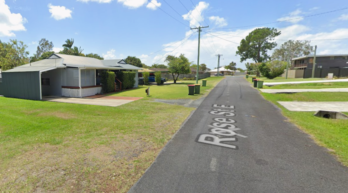
City of Moreton Bay has moved the long-planned Mango Hill drainage upgrades into construction, and the first stage is now under way on Rose Street West and Mary Street West. The project matters because council says those streets still lack kerbs and adequate drainage, leaving nearby homes exposed to shallow flooding when heavy rain hits.


The 22 October downpour did not prove the new works either way. It did, however, underline why the project exists. Council says this is a chronic drainage problem, not a one-off nuisance, and the upgrade is meant to fix the street network rather than respond to a single storm.

A fix for streets that still pool

Council’s project page says current works began in mid-August 2026. Early activity includes utility relocations, some vegetation removal and driveway removals where needed to make room for the drainage layout. That tells residents this is a full street rebuild, not a minor kerb-and-channel patch.

The scope is broader than many people might expect. Council says the work will bring new stormwater drains and kerbs, replace sections of road pavement, reinstate driveways to standard designs, and add footpaths and landscaping. It also says the design follows water sensitive urban design principles so stormwater can move more effectively through the road reserve.

That approach should bring long-term benefit, but council has not published measured results yet. It would be premature to claim the finished works have already reduced flooding. For now, the upgrade remains a promise of better drainage, not a proven outcome.

Rain still keeps the suburb on alert

The storm on 22 October showed that wet weather still affects Mango Hill. City of Moreton Bay’s weather-impacted roads page later listed Chermside Road between John Street and Kinsellas Road West as closed. That is not the same as a failed drainage project, but it is a reminder that the suburb still copes with weather pressure.

The broader weather event was significant across Moreton Bay, with official road and flood updates spreading across the region. But in Mango Hill, the key point is local: the wet weather arrived while council was already in the middle of a drainage rebuild that has been discussed for years.

That distinction matters. It is fair to say the suburb remains vulnerable in heavy rain. It is not fair to say the new works have failed, or that they were fully tested, without evidence.

A staged rebuild across Rose, Mary and Winifred streets

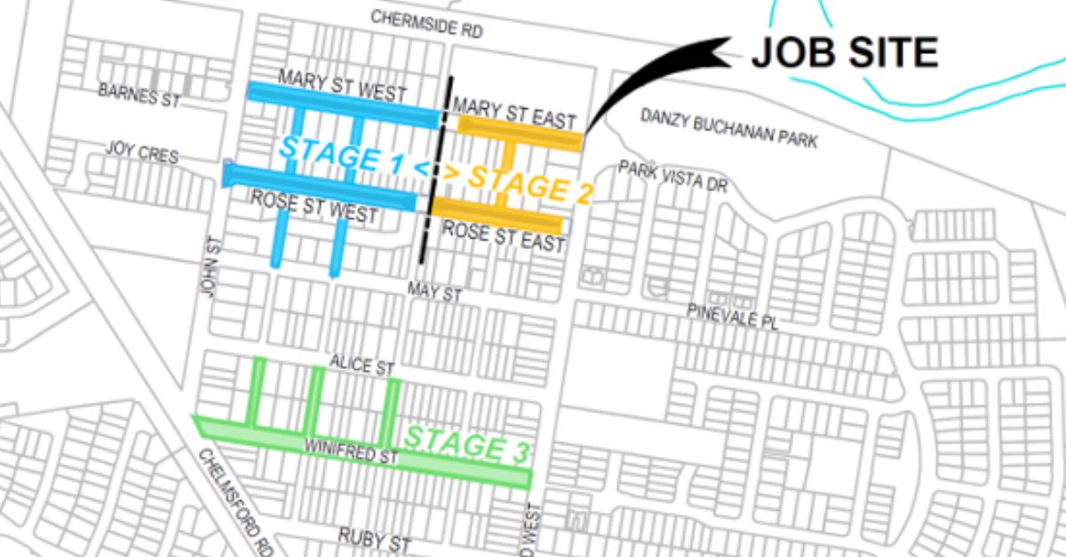
Council has spread the project over several years. Stage 1 covers Rose Street West and Mary Street West from September 2026 to April 2027. Stage 2 moves to Rose Street East and Mary Street East from April 2027 to September 2027. Stage 3 is Winifred Street, listed for the 2028/29 financial year.

The 2025–26 budget materials place the project in Division 4 and say service relocations will occur in 2025–26 before construction starts in 2026–27. The reviewed budget page does not publish a separate project cost, so a verified dollar figure is not available here.


What is clear is that the suburb has been waiting for this work for a long time. Council says the streets have had inadequate drainage. Residents will now have to live with construction disruption before they see the long-term payoff. For Mango Hill, the real test is not whether rain returns. It is whether the staged rebuild finally delivers the drainage the suburb has needed for years.

Published 23-October-2026

Petrie TAFE Centre of Excellence: What $60 Million will Build for Locals

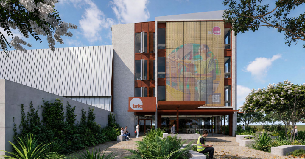
Petrie students who want a career in manufacturing or the trades will soon have a purpose-built TAFE centre a short walk from the train station.


The Queensland Government announced the news this week and said Queensland company FKG Group has been appointed as contractor. Petrie is the second of four such centres to begin construction across the state. Rockhampton got going earlier this year.

What is Planned for the Site

TAFE Centre
Photo Credit: Artist Impression/ Supplied

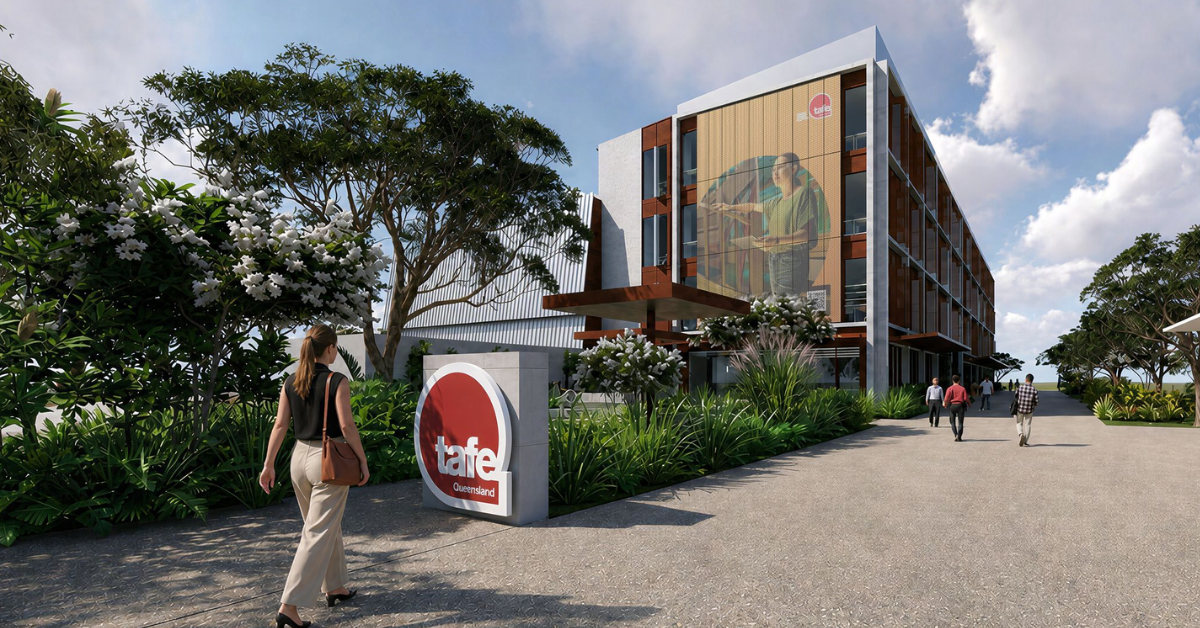
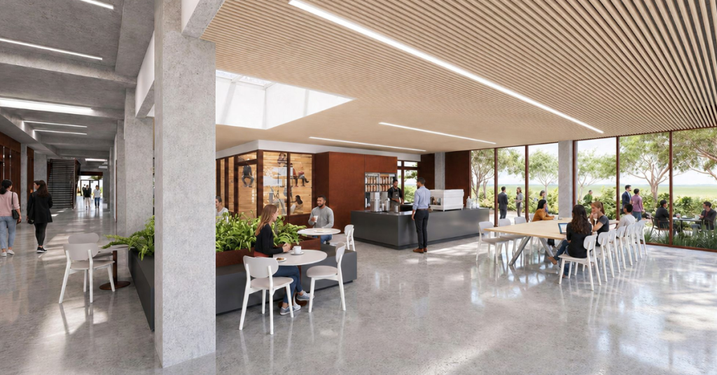
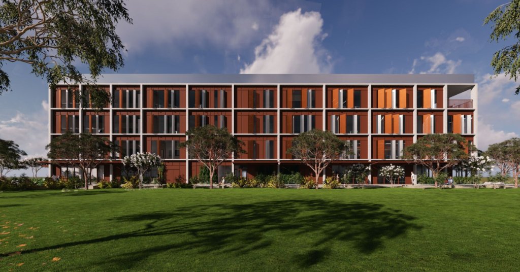
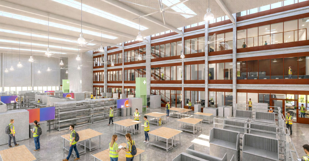
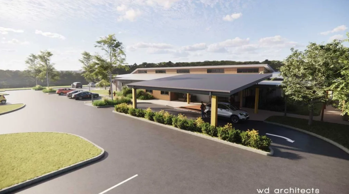
An Advanced Manufacturing Hub sits at the heart of the plan. Around it, the government says, will be training space for metal fabrication, engineering and trades, plus instrumentation labs and rooms built for industry to work alongside students. The Department of Trade, Employment and Training lists construction, engineering and electrotechnology as the centre’s main focus.

The hub is aimed at the region’s manufacturing sector, which both the state government and the City of Moreton Bay describe as a billion-dollar industry. Designs are still subject to change, the department notes.

Why Petrie?

TAFE Centre
Photo Credit: Artist Impression/ Supplied

So why build here? Part of the answer is the land. The centre will go up at Moreton Bay Central on a site the City of Moreton Bay transferred for the project. The council says it is the third-largest local government in Australia by population, so a large pool of future students lives close by.

Nearby, the Moreton Bay Indoor Sports Centre is planned as a venue for the 2032 Olympic and Paralympic Games. Mayor Peter Flannery said the land transfer should lead to more jobs in high-demand fields and strengthen the area’s name as a hub for education and technology.

What Locals and Leaders are Saying

TAFE Centre
Photo Credit: Artist Impression/ Supplied

For Kerri-Anne Dooley, the Member for Redcliffe, the appeal is simple. Manufacturing and construction matter in her area, and a campus close to home means thousands of people can study without leaving the community. Ariana Doolan, the Member for Pumicestone, agreed and said the training should lead locals into rewarding careers.

TAFE Queensland chief executive Tim Rawlings focused on the learning itself. He said students and apprentices will get hands-on training in advanced manufacturing, construction, engineering and electrotechnology. Close ties with employers and government, he said, should keep courses in step with what workplaces need and send graduates out job-ready from day one.

Manufacturing Minister Dale Last added that a skilled workforce is key to the industry’s future growth.


Part of a Bigger Plan

TAFE Centre
Photo Credit: Artist Impression/ Supplied

Petrie is one piece of a $201.1 million state investment. The other centres are planned for the Sunshine Coast, Rockhampton and the Southern Moreton Bay Islands, where the focus will be marine training. The government describes the four centres as an election commitment.

Minister Ros Bates said communities across Queensland need more tradies and skilled workers, and that the new facility is meant to help fill those gaps while supporting housing, infrastructure and Games preparations. The government points to a predicted peak shortfall of 50,000 construction workers, though it has not said where that figure comes from.

No completion date for the Petrie centre has been announced.

Published Date 07-October-2026

Mango Hill Woolworths Seeks Community Feedback as Plans Remain Before Council

Mango Hill residents are being invited to have their say on plans for a new Woolworths shopping precinct on Anzac Avenue, with the proposed supermarket, specialty stores and automated eStore now the subject of community feedback while the development application remains before City of Moreton Bay.

The project, proposed for 1859 Anzac Avenue, has reached what Woolworths describes as Stage 3, “Community Engagement and Feedback”. Residents can view information about the development and provide comments through the project’s website as the proposal continues through the planning process.

City of Moreton Bay issued a Request for Further Information in January as part of its assessment of the development application, which was lodged in September last year.


Community Feedback Isn’t Formal Public Notification

There is an important distinction for residents wanting to comment on the plans. The feedback Woolworths is seeking now is not the statutory public-notification period attached to the development application.

Woolworths’ published project timeline identifies community engagement as Stage 3, with public notification following as a separate Stage 4. That later stage is when formal submissions can be made on the development application as part of the planning process.

The distinction is particularly relevant because the application is still being assessed. Woolworths’ current project information says it will prepare and lodge a response to Council’s January Request for Further Information before the proposal moves to public notification.

Residents can therefore provide feedback to Woolworths now, but should not assume that doing so amounts to making a formal submission on the development application.

A Supermarket, an eStore — and a New Anzac Avenue Intersection

At the centre of the proposal is a full-line Woolworths supermarket alongside an automated eStore designed to service online grocery orders for home delivery and direct-to-boot collection. Woolworths says the eStore would be only the second of its kind in Queensland.

Around 20 specialty and commercial tenancies are also proposed, with potential uses including health and medical services, food and beverage outlets and other shops and services. Current project information puts customer parking at more than 320 spaces.

Getting vehicles into the precinct would require a new signalised intersection on Anzac Avenue. Woolworths says the proposed access point was selected following traffic-engineering and arborist advice, with new pedestrian paths also planned.

That work intersects with one of Anzac Avenue’s most recognisable features. Woolworths says construction of the intersection may require the removal of up to four mango trees and that it intends to undertake replacement planting and landscaping along the site’s frontage.

The formal application, DA/2025/4809, covers more than the shopping centre itself. It also seeks approval for subdivision into four lots, together with a drainage reserve and new road.

There Are Still More Steps Before a Decision

For now, the proposal remains exactly that — a proposal. The current feedback campaign does not amount to planning approval, nor does it mean construction is about to begin.

Council’s Request for Further Information forms part of its assessment, while Woolworths’ own published timeline places statutory public notification after the current community-engagement stage. Council determination comes later.


For residents interested in the development, that makes the timing important. Feedback can be provided directly to Woolworths during the present engagement process, while anyone wanting to make a formal submission on the development application will need to watch for the separate statutory public-notification period.

More information about the proposal and the current community-feedback process is available through the Mango Hill Woolworths project website.

Published 30-September-2026

North Lakes to Get New Scooter Track and Dog Park

Young scooter riders and four-legged locals are both set to get new territory in North Lakes, with a children’s scooter track and dog off-leash area planned for Memorial Drive.

A shelter and new car park are also part of the Memorial Drive project, bringing several recreation facilities together rather than creating a stand-alone dog park.

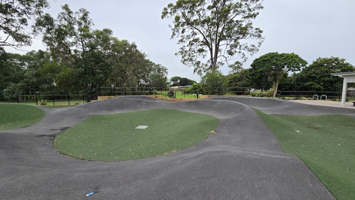
For families, the more unusual addition will be the scooter track. City of Moreton Bay describes it specifically as a “scooter track for young children” — not a skate park or pump track — pointing to a space aimed at younger riders finding their feet on wheels.


A Track for the Younger Crowd

Exactly what the track will look like has not yet been made public.

Council has tried the idea elsewhere in Moreton Bay. At Blatchford Sporting and Recreation Reserve in Murrumba Downs, a scooter track was designed for children from toddler to primary-school age, with a concrete riding area, obstacles, seating and landscaping.

There is not yet enough public detail to say whether Memorial Drive will follow that model or include the miniature streets, signs and intersections sometimes found in learn-to-ride circuits.

What is clear is that it would fill a different recreation niche in North Lakes.

The suburb has developed an increasingly varied collection of parks and sporting spaces as it has grown, from the playing fields around Woodside and Kinsellas to the recreation facilities at Aurora Boulevard Park. Aurora Boulevard already has a skate park alongside playgrounds and a fenced dog off-leash area, giving older and more confident riders somewhere to practise.

Memorial Drive would add something deliberately pitched at younger children.

New Territory for North Lakes Dogs

The dog off-leash component has been in the works for longer.

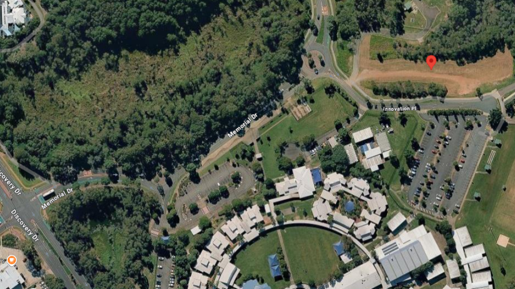
In 2025, Council identified 731 Memorial Drive as a potential location for a new North Lakes dog off-leash area. At the time, it was one of two sites being considered in the suburb, along with Oxley Street Park.

Photo Credit: Google Maps

The latest budget now identifies a Memorial Drive project combining a dog off-leash area with the children’s scooter track, shelter and new car park. However, the published budget information does not specify a street number, so 731 Memorial Drive should not yet be treated as the confirmed footprint of the combined project.

North Lakes already has off-leash facilities at Aurora Boulevard Park and Woodside Sports Ground, but the Memorial Drive proposal emerged from Council’s broader search for additional dog recreation sites.

The final layout has not yet been published. That leaves details such as the size of the dog area, its fencing arrangement, whether dogs of different sizes will have separate spaces and whether agility equipment will be provided still to be confirmed.

Council’s general guidelines for new off-leash areas consider secure entrances, shade, drinking water, seating and links to paths, but they do not confirm what will ultimately be installed as part of the Memorial Drive project.

More Than the Original Dog Park Idea

The latest budget takes the Memorial Drive plans beyond a stand-alone dog park proposal, with several recreation elements now listed together.

City of Moreton Bay’s adopted 2026–27 Budget lists construction of the children’s scooter track and dog off-leash area together with a shelter and new car park.

That represents a clear step forward from 2025, when the potential Memorial Drive dog park was still among a collection of sites requiring further assessment, planning and design.

Some important details are still to come. The published budget material does not provide a stand-alone total cost for the project, while a final public concept plan, detailed construction timetable and confirmed opening date have not been located.

But the shape of the Memorial Drive project is now much clearer. Instead of another single-purpose recreation space, the plan brings together somewhere for little riders to practise, dogs to run and families to stop for a while.

Updated 24-September-2026

Black Spot Safety Hump Planned for Prospect Street at Bruce Highway Service Road

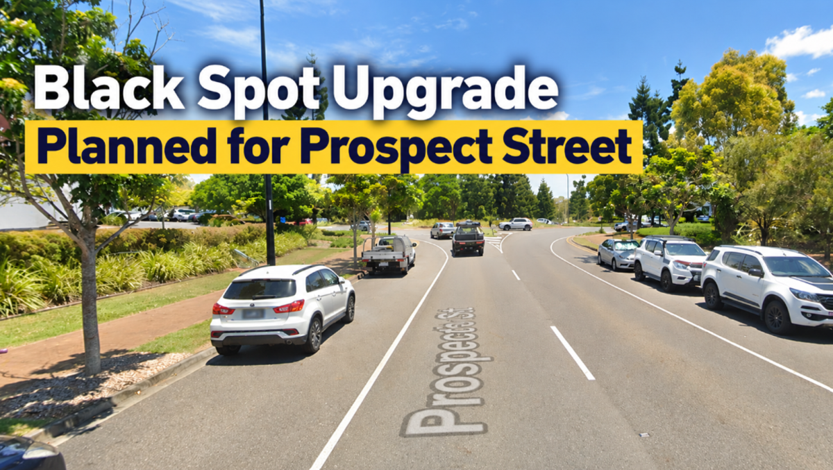
A raised traffic-calming treatment is planned for the southern end of Prospect Street in North Lakes, with $93,000 in Australian Government Black Spot funding allocated to slow vehicles approaching the service road north of the Bruce Highway.

Rather than a major intersection rebuild, the project centres on one specific measure: a raised hump on the Prospect Street approach. Federal project records describe the site as “Prospect Street – Service Road north of Bruce Highway” and identify the project as being in planning.

The work applies to the Bruce Highway end of Prospect Street, not the full road through the North Lakes commercial and town-centre area.


Read: Dakabin Wildlife Hospital Moves Closer to Construction


A 2025 Finish Has Slipped Well Into 2027

The Australian Government committed $93,000 to the project through the Black Spot Program, with the initial federal timetable putting the work between July and December 2025.

That schedule did not hold. A Commonwealth status report in September 2025 listed the project as “Not Started”, and subsequent federal program material extended the expected completion window to June 2027.

City of Moreton Bay has also carried the Prospect Street project into its 2026–27 Budget.

As of September 2026, North Lakes Today has found no later public record confirming that construction or preliminary works have begun, nor evidence that a contractor has been appointed. A firm construction start date has not been published, so the upgrade should not yet be described as underway.

One Treatment Targets the Approach

The approved scope is considerably narrower than many intersection safety projects. Federal records describe the core treatment simply as “providing a raised hump on approach”.

There is no indication in the published scope of new traffic signals, turning lanes, pedestrian refuges, cycle facilities, medians or substantial intersection reconstruction. Instead, the physical road treatment is intended to make motorists reduce speed as they approach the service-road junction.

The location is also important. The project concerns the Prospect Street approach to the service road north of the Bruce Highway, rather than the North Lakes Drive end of Prospect Street near Westfield North Lakes.

What Put the Site on the Black Spot List?

The reason this particular location secured Black Spot funding is less clear from the material released publicly.

Commonwealth project records do not provide a crash count for the site, identify particular collision types or say whether pedestrians or cyclists were involved. North Lakes Today also found no publicly released road-safety audit or Black Spot nomination assessment setting out the case behind the treatment.

That means the funding should not be taken by itself as evidence that Prospect Street has a particular crash record. Black Spot projects can qualify through casualty-crash history, while the program also allows proactive treatments where an engineering assessment identifies a serious safety risk.

The available Prospect Street records do not establish which pathway was used. What they do establish is that slowing vehicles on the approach was selected as the appropriate treatment.


Read: Historic Kallangur Church to Stay as New Special School Moves Ahead


Motorists Are Still Waiting for the Works Schedule

With the delivery window now extending to June 2027, the practical construction details are yet to emerge.

No public construction notice located for the project sets out lane closures, traffic control, working hours, parking restrictions or changes to pedestrian and property access. Those details should become clearer once the project moves beyond planning.

For now, Prospect Street has a funded Black Spot treatment and a revised delivery window, but no confirmed construction start. Once installed, the change should be straightforward for motorists: a physical traffic-calming treatment requiring vehicles to slow before reaching the service-road junction.

Published 9-September-2026

Narangba East Future Takes Shape as Housing, Industry and Acreage Plans Go Public

A new vision for Narangba East would open parts of the district to suburban housing and industrial development while retaining other pockets as rural residential land, as City of Moreton Bay asks residents to weigh in on how the 1020-hectare area should change.

Council has released its draft Future Directions Report for the Narangba East Rural Residential Investigation Area after almost three years of planning investigations and consultation.

Public feedback is open until 4pm on Friday, 9 October 2026. The report does not rezone properties or approve development, but will help shape a future planning scheme amendment governing what can eventually be built across the area.


Housing Is Back in the Picture

One of the most consequential elements of the updated vision is the amount of land identified for future housing.

The Queensland Government placed conditions on Council’s current Temporary Local Planning Instrument (TLPI), including a requirement to provide for housing as well as employment within the affected area. Several parts of Narangba East are consequently identified for residential development.

The draft envisages small-lot detached homes, duplexes, townhouses and retirement living. Emerging Community areas would generally have a minimum net residential density of 20 lots per hectare, with buildings around a maximum 12 metres, or three storeys.

Mayor Peter Flannery said Narangba East had long been identified as an area capable of supporting Moreton Bay’s growth.

“It’s no secret that growth is coming to City of Moreton Bay and parts of Narangba East have long been earmarked as a key location to support future urban growth,” Cr Flannery said.

He said the city’s population was projected to grow from roughly 530,000 today to one million over the next 30 or so years.

What’s Proposed for Narangba East?

Future housing: Small-lot houses, duplexes, townhouses and retirement living in designated Emerging Community areas.

Employment land: Light and general industry around parts of the existing industrial precinct, including the Old Gympie Road area.

Rural residential: Some established acreage areas would retain their existing rural-residential role.

Environment: Environmental corridors and links would be retained or established, with the investigation area sitting within a Koala Priority Area.

Infrastructure: Significant road and servicing upgrades would be needed as development occurs.

What happens now: This is a proposed planning direction, not a rezoning. Formal changes would require a planning scheme amendment and further consultation.

Industry Stays, but With Buffers

Employment land remains a sizeable part of the vision, particularly around existing industrial areas near Old Gympie Road and Richards Road.

Both light and general industry are proposed, with controls intended to manage noise, vibration, odour, lighting, traffic and operating hours near homes. General industry would generally be separated from future urban residential areas by at least 250 metres, with lower-intensity light industry providing a transition in some locations.

Not every acreage neighbourhood would change. Dean Drive, Casino Court, Gavin Court and Jane Place are proposed to remain Rural Residential because they sit within an environmental health buffer west of Old Gympie Road.

Earlier Consultation Revealed the Fault Lines

Council already has a sense of where some of the debate will lie.

During consultation in 2025, it received 108 survey responses, while another 99 people took part in 14 small-group sessions. The participants were self-selecting, so the figures cannot be treated as a poll of Narangba East as a whole, but they show considerable concern about both major forms of development being considered.

Thirty per cent of survey respondents opposed residential development and another 24 per cent expressed concern. Twenty per cent were supportive and 16 per cent cautiously open.

Industrial and employment development met stronger resistance: 40 per cent opposed it and 29 per cent were concerned, compared with 15 per cent supportive and 7 per cent cautiously open.

Roads, infrastructure, environmental protection, neighbourhood character and certainty for existing landowners also emerged repeatedly. Roads and pathways ranked as the most important immediate priority, while protection and enhancement of the natural environment came first when participants looked 20 to 30 years ahead.

Growth Will Depend on the Infrastructure

Old Gympie Road and New Settlement Road would eventually need significant upgrades, including provision for a four-lane standard. Callaghan, Mackie and McPhail roads are also identified for future work, along with an extension of Marks Road to Callaghan Road.

Council also wants better public transport links between Narangba railway station, Narangba East and destinations including North Lakes.

The report identifies what would be needed to support future development rather than setting out a fully funded construction timetable. Delivery would occur over time and depend on development, funding and coordination between Council, the State Government, utilities and developers.

Likewise, a future change in zoning would not force an existing landowner to sell or redevelop. Lawful uses could continue, potentially leaving established acreage properties beside areas that change progressively over time.

For some residents, the question may therefore be not only what Narangba East becomes, but how quickly the transition happens and what infrastructure arrives with it.


The Map Is Not the Final Word

The current TLPI remains in place while the longer-term framework is settled and is due to expire in June 2028 unless repealed earlier.

The consultation now under way is focused on the broad direction for Narangba East. A second opportunity for public input will come when the proposed planning scheme amendment sets out the formal planning controls.

Deputy Mayor Jodie Shipway said residents would have another chance to comment.

“You can have your say on the draft Future Directions Report, but it won’t be your last chance to provide feedback on the future of the Narangba East Rural Residential Investigation Area,” she said.

Submissions from this round will help inform the next stage. Until the planning scheme amendment process is completed, the new Narangba East map remains Council’s proposed direction rather than new zoning.

Published 8-September-2026

Dakabin Wildlife Hospital Moves Closer to Construction

Plans for Dakabin’s $15 million wildlife hospital have taken another step towards construction, with the first contractor procurement round now closed and site works scheduled to begin before the end of the year.


Expressions of interest from head contractors closed on 4 September for the Moreton Bay Wildlife Hospital at 420 Old Gympie Road.

The process is for construction rather than design, with a restricted construction tender anticipated in October. A builder has not yet been appointed and construction has not started.

City of Moreton Bay expects site preparation to begin in late 2026, ahead of main construction from early 2027. Its 2026–27 Budget also provides for power, water and communications connections at the site.

From Playing Fields to Wildlife Hospital

The hospital will occupy part of the former North Pine Playing Fields, near Boundary Road and the Bruce Highway.

Council considered more than 100 properties before choosing Dakabin, with road access, services, relatively flat terrain and room for future expansion among the factors considered. The land was previously valued at about $3 million.

In October last year, Council granted the Moreton Bay Wildlife Hospital Foundation an initial 10-year community lease over the property for $1 a year. The peppercorn arrangement followed the signing of a $15 million State Government funding agreement for the hospital and education hub.

Then Acting Mayor Jodie Shipway said having the hospital in Moreton Bay would cut the distance injured animals had to travel for emergency treatment.

“This new facility will mean injured wildlife such as koalas, kangaroos and echidnas can be treated locally rather than being driven up to two hours for care at RSPCA in Wacol or Australia Zoo in Beerwah,” she said.

Keeping Treatment Closer to Home

Moreton Bay currently sits between the major wildlife hospitals at Wacol and Beerwah, while the Moreton Bay Wildlife Hospital Foundation estimates more than 7,000 animals leave the region for medical treatment each year.

Foundation director Christine West said when the lease was announced that the Dakabin facility would benefit both injured animals and the people transporting and caring for them.

“The establishment of the Moreton Bay Wildlife Hospital is such a vital step forward, a dedicated local facility that will keep care close to home, reducing transport stress on injured animals and easing the burden on our rescue network,” she said.

The hospital is intended primarily for the triage and treatment of injured and orphaned native wildlife. Animals will be assessed and stabilised at Dakabin, with some later transferred to carers or specialist rehabilitation facilities.

Expected patients include koalas, kangaroos, possums, gliders, birds, bats, snakes and turtles. Domestic and exotic pets will not be treated.

Builder Search Moves Ahead

Plans include specialist clinical and animal-care areas, along with administration and community facilities. Education and training are also part of the longer-term model.

A 24-hour service remains an ambition rather than a confirmed feature from opening, with round-the-clock operations dependent on staffing and funding.

The Foundation, established by local volunteers in 2022, is overseeing development of the project. An appropriately licensed operator is expected to eventually run the hospital’s clinical service.


The EOI process has now closed, with the restricted construction tender anticipated in October. Site preparation remains scheduled for late 2026, ahead of construction from early 2027.

Published 7-September-2026
Petrie Campus Scholarship Program Reaches Milestone Supporting Nearly 100 Undergraduates

Twenty-three students scattered across the bustling North Lakes, Petrie, Mango Hill and Kallangur corridor are suddenly finding room to breathe as fresh financial backing targets the escalating costs of modern higher education.


Strengthening the Local Pipeline

Why should a bright academic future depend entirely on the state of a bank account? Local leaders refuse to let household budgets dictate who gets to succeed. Operating out of the Petrie campus, the annual City of Moreton Bay Scholarship Program has steadily built a reliable net for local learners since 2020. 

Ninety-one students have now navigated their university years with this backing, transforming raw potential into professional capability right where they grew up.

Adapting to Economic Realities

Bursaries jumped from $2,000 to $2,500 this year, responding directly to the pinch of inflation. Administrators also introduced the programme’s inaugural Indigenous Study Support Bursary, widening the gates for regional participation. Beyond these sixteen flexible cash grants sit seven major undergraduate scholarships, each worth $8,000 annually for the entire duration of a degree. 

Could a few thousand dollars really mean the difference between dropping out and earning a diploma? For many young adults juggling rent and textbooks, the answer is an absolute yes.


Fueling Tomorrow’s Economy

Petrie is expanding at breakneck speed. Where will the region find the engineers, teachers, and innovators it needs tomorrow? The answer is sitting in today’s lecture halls. By removing financial barriers, the collaborative initiative ensures homegrown talent stays put rather than drifting away to bigger cities. 

Graduates step straight from campus into local enterprises, feeding their newly minted expertise back into the neighbourhoods that supported them from the start.

Updated 2-September-2026

Major Road and Drainage Upgrade Gets Underway in Mango Hill

A long-planned overhaul of some of Mango Hill Village’s older streets is moving into construction, with Rose Street West and Mary Street West first in line for new drainage, road pavement and footpaths.


Work on the first stage is due to begin this month, starting a three-stage program that will eventually extend along the eastern sections of Rose and Mary streets before reaching Winifred Street.

Preparatory work began in mid-August, including utility relocations, vegetation removal and work around driveways to make way for new drainage.

More Than a Resurfacing Job

The existing road pavement will be removed and replaced, with new kerbs, stormwater drainage and footpaths built through the first stage.

Affected driveways will also be reconstructed, including the removal of existing crossover pipes and headwalls where required.

Council says Rose, Mary and Winifred streets currently lack kerbs and adequate drainage, with existing drains and pipes contributing to shallow flooding on residential properties during heavy rain.

New and upgraded open drainage channels form part of the wider project, along with landscaping, turf and replacement street trees. Some trees are being removed where they conflict with utility relocations, stormwater pipes and drainage works.

The design also incorporates Water Sensitive Urban Design principles. Council has not identified specific rain gardens, bioretention basins or vegetated swales in its current project information, but has confirmed a combination of new stormwater infrastructure, upgraded open drains and landscaping.

The project is intended to improve how stormwater is managed through the road reserve and address existing drainage deficiencies. Council has not said the works will eliminate flood risk.

Years in the Planning

The upgrade has been on the drawing board for several years.

Planning and design for drainage works in Mango Hill Village appeared in Council’s 2024–25 program, with service relocations and approvals continuing through 2025–26.

Residents had raised the issue earlier. A 100-signature petition presented to Council in 2019 concerned road and drainage upgrades in Mango Hill Village, including the protection of mature trees as works progressed.

Three Stages of Work

Stage 1 covers Rose Street West and Mary Street West and is expected to involve about 20 weeks of construction. Council gives the broader Stage 1 program as September 2026 to April 2027, with timing subject to weather and unforeseen conditions.

Stage 2 will move to Rose Street East and Mary Street East and is currently scheduled from April to September 2027.

Winifred Street forms Stage 3, which Council’s latest timetable places in the 2028–29 financial year.

The project appears in City of Moreton Bay’s 2026–27 Budget program, although Council has not published a standalone total project cost or separate Stage 1 construction figure in its current public material.

What Residents Can Expect

Construction will affect traffic and property access as crews move through Rose Street West and Mary Street West.

Council says it will work with residents to maintain access where possible, although individual driveways will be temporarily unavailable while they are reconstructed. Pedestrians will be directed around active work areas.

Residents directly affected by early vegetation and driveway works have already received written notification.

Council has not published project-specific working hours or announced blanket road closures, changes to waste collection or public transport arrangements.

For now, the disruption will be concentrated on the western sections of Rose and Mary streets. Their eastern ends follow next year, while Winifred Street remains a later stage of the program.


Published 5-September-2026