


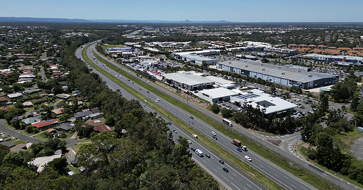
Underground wildlife crossings have been included in plans for the Bruce Highway north of North Lakes, as the State maps out a major expansion of the busy corridor through Moreton Bay.
The Department of Transport and Main Roads’ preferred plan covers 18 kilometres of the Bruce Highway between Anzac Avenue at North Lakes and Caboolture-Bribie Island Road.


The project is primarily about carrying more traffic. It would add a fourth lane in each direction between Anzac Avenue and Uhlmann Road, while further north, new collector-distributor roads would separate local traffic from vehicles continuing along the highway.
But the plans also make room for wildlife.


Wildlife Movement Included in the Design
TMR’s fly-through of the preferred design identifies an underground fauna crossing spanning the highway south of the northbound and southbound service centres in the Burpengary-Morayfield area.
Another fauna crossing is shown further north.


The locations are well north of Anzac Avenue and are not the wildlife crossing previously sought near North Lakes. They do, however, show fauna movement being factored into plans for a highway expected to become substantially bigger.
It is also not happening in isolation.
South of North Lakes, the $948 million Bruce Highway upgrade around the Gateway Motorway interchange includes fauna fencing and a fauna underpass running east-west beneath the Gateway Motorway, Bruce Highway and Gympie Arterial Road interchange.
The next stage, extending north across the Pine River towards Dohles Rocks Road, includes another fauna underpass on the northern side of the river bridges.
Together, the projects put several wildlife connections into plans for the motorway and highway corridor running towards North Lakes.
A Corridor Carrying 160,000 Vehicles a Day
The scale of the transport challenge helps explain the size of the works being planned.
TMR says about 160,000 vehicles travel between the Moreton Bay Region and north Brisbane each day on the Gateway Motorway, Bruce Highway and Gympie Arterial Road. Traffic levels across that wider corridor are expected to increase by about 50 per cent by 2041.
North of Anzac Avenue, the preferred 18-kilometre Bruce Highway upgrade would also overhaul the Uhlmann Road, Buchanan Road and Caboolture-Bribie Island Road interchanges. New highway bridges are proposed over Burpengary Creek and the Caboolture River.
The preferred option was released for community consultation in July 2025. Consultation closed in September, with TMR saying the feedback is being reviewed and will be considered in future project phases.
Crossings Are Planned, Not Yet Built
There is an important distinction between what appears on the plans and what motorists — or wildlife — will eventually see.
The Anzac Avenue-to-Caboolture-Bribie Island Road upgrade remains in planning. The preferred design is subject to further project development, and construction funding would still need to be secured.
Further south, work is more advanced. Detailed design is underway on the Gateway to Bruce Upgrade, which incorporates the $948 million Bruce Highway Stage 1 project. Construction is expected to begin in late 2026, subject to environmental approvals.
The adjoining Pine River-to-Dohles Rocks Road stage is also in detailed design. The Australian and Queensland governments have committed $30 million towards its design, but further funding is required for construction.
For North Lakes and surrounding suburbs, the plans offer an early look at how one of the region’s biggest transport corridors could change as Moreton Bay continues to grow.
More lanes and bigger interchanges dominate the engineering. But wildlife movement is now on the plans too.
Published 20-August-2026
CLICK ANY LOGO TO SEE PUBLICATION