Wyllie Park Trial Brings Homelessness Support Closer in Petrie

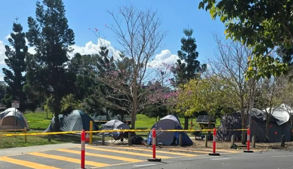
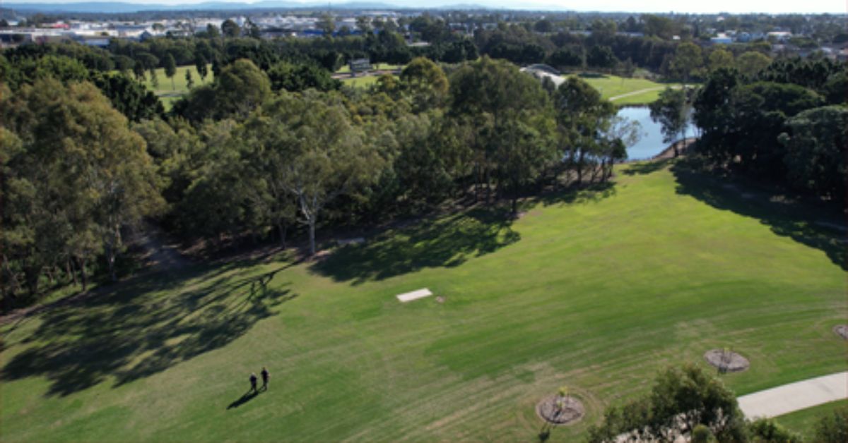
For people experiencing homelessness in Moreton Bay, Wyllie Park in Petrie has become a temporary place to pitch a tent while staying within reach of local outreach and housing support during a 12-month trial.


Support Takes Shape Around Wyllie Park Trial

Encircle Community Services has been preparing for the camping ground by working with accredited organisations and services on a regular roster of support for people staying at Wyllie Park.

Its HOAP team was already visiting the park and other locations across Moreton Bay before the camping ground was announced. The team will continue attending Wyllie Park twice a week alongside other support services.

Just 650 metres from the park, Encircle’s Pine Rivers Neighbourhood Centre is also preparing for a possible increase in people seeking help.

The organisation has long advocated for safe locations close to support services where people experiencing homelessness can have some stability while accessing further assistance.

Other recognised support organisations, including government departments, will have ongoing access to campers at Wyllie Park, with services able to assist people towards secure accommodation.

Community organisation Nourish Street Inc also visited the site in late August as preparations were under way. At the time, it reported that people already staying in the park had described interactions with other park users as generally going well, with little tension.

Its update also raised the importance of support and pathways into housing operating alongside the camping area.

A Temporary Place to Stay

The Wyllie Park trial has 30 designated tent sites for no more than 60 people, with registration now open.

Campers must be at least 18 and registered to receive housing or housing support through the State before a site can be allocated.

Stays are limited to 21 days at a time and a maximum of 42 days in any rolling 12-month period. Longer stays may be considered at the authorities’ discretion.

The camping ground is free, but only tents can be used for overnight stays. Caravans, camper trailers, camper vans and motorhomes are not permitted to remain overnight.

Park Facilities Remain Shared

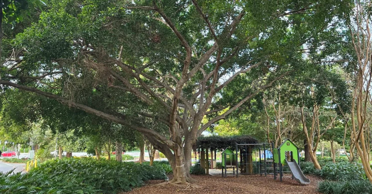
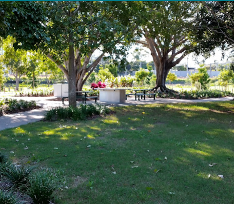
Preparations at Wyllie Park have included designated camping sites, lighting and security measures. The camping ground has toilets, waste bins and other public amenities, while showers were also identified among the facilities available to campers.

CCTV and regular security patrols are in place. Fires and generators are prohibited, while animals are not allowed except for guide, hearing or assistance animals.

The wider Wyllie Park remains available to the public, with campers required to keep their sites tidy, keep paths clear, minimise noise and use signed parking areas.


The camping ground is not intended to replace emergency housing, crisis accommodation or homelessness support services. Instead, the Wyllie Park trial operates as a temporary camping option while local organisations continue outreach and assistance for people seeking more secure accommodation.

Published 15-September-2026

Narangba East Future Takes Shape as Housing, Industry and Acreage Plans Go Public

A new vision for Narangba East would open parts of the district to suburban housing and industrial development while retaining other pockets as rural residential land, as City of Moreton Bay asks residents to weigh in on how the 1020-hectare area should change.

Council has released its draft Future Directions Report for the Narangba East Rural Residential Investigation Area after almost three years of planning investigations and consultation.

Public feedback is open until 4pm on Friday, 9 October 2026. The report does not rezone properties or approve development, but will help shape a future planning scheme amendment governing what can eventually be built across the area.


Housing Is Back in the Picture

One of the most consequential elements of the updated vision is the amount of land identified for future housing.

The Queensland Government placed conditions on Council’s current Temporary Local Planning Instrument (TLPI), including a requirement to provide for housing as well as employment within the affected area. Several parts of Narangba East are consequently identified for residential development.

The draft envisages small-lot detached homes, duplexes, townhouses and retirement living. Emerging Community areas would generally have a minimum net residential density of 20 lots per hectare, with buildings around a maximum 12 metres, or three storeys.

Mayor Peter Flannery said Narangba East had long been identified as an area capable of supporting Moreton Bay’s growth.

“It’s no secret that growth is coming to City of Moreton Bay and parts of Narangba East have long been earmarked as a key location to support future urban growth,” Cr Flannery said.

He said the city’s population was projected to grow from roughly 530,000 today to one million over the next 30 or so years.

What’s Proposed for Narangba East?

Future housing: Small-lot houses, duplexes, townhouses and retirement living in designated Emerging Community areas.

Employment land: Light and general industry around parts of the existing industrial precinct, including the Old Gympie Road area.

Rural residential: Some established acreage areas would retain their existing rural-residential role.

Environment: Environmental corridors and links would be retained or established, with the investigation area sitting within a Koala Priority Area.

Infrastructure: Significant road and servicing upgrades would be needed as development occurs.

What happens now: This is a proposed planning direction, not a rezoning. Formal changes would require a planning scheme amendment and further consultation.

Industry Stays, but With Buffers

Employment land remains a sizeable part of the vision, particularly around existing industrial areas near Old Gympie Road and Richards Road.

Both light and general industry are proposed, with controls intended to manage noise, vibration, odour, lighting, traffic and operating hours near homes. General industry would generally be separated from future urban residential areas by at least 250 metres, with lower-intensity light industry providing a transition in some locations.

Not every acreage neighbourhood would change. Dean Drive, Casino Court, Gavin Court and Jane Place are proposed to remain Rural Residential because they sit within an environmental health buffer west of Old Gympie Road.

Earlier Consultation Revealed the Fault Lines

Council already has a sense of where some of the debate will lie.

During consultation in 2025, it received 108 survey responses, while another 99 people took part in 14 small-group sessions. The participants were self-selecting, so the figures cannot be treated as a poll of Narangba East as a whole, but they show considerable concern about both major forms of development being considered.

Thirty per cent of survey respondents opposed residential development and another 24 per cent expressed concern. Twenty per cent were supportive and 16 per cent cautiously open.

Industrial and employment development met stronger resistance: 40 per cent opposed it and 29 per cent were concerned, compared with 15 per cent supportive and 7 per cent cautiously open.

Roads, infrastructure, environmental protection, neighbourhood character and certainty for existing landowners also emerged repeatedly. Roads and pathways ranked as the most important immediate priority, while protection and enhancement of the natural environment came first when participants looked 20 to 30 years ahead.

Growth Will Depend on the Infrastructure

Old Gympie Road and New Settlement Road would eventually need significant upgrades, including provision for a four-lane standard. Callaghan, Mackie and McPhail roads are also identified for future work, along with an extension of Marks Road to Callaghan Road.

Council also wants better public transport links between Narangba railway station, Narangba East and destinations including North Lakes.

The report identifies what would be needed to support future development rather than setting out a fully funded construction timetable. Delivery would occur over time and depend on development, funding and coordination between Council, the State Government, utilities and developers.

Likewise, a future change in zoning would not force an existing landowner to sell or redevelop. Lawful uses could continue, potentially leaving established acreage properties beside areas that change progressively over time.

For some residents, the question may therefore be not only what Narangba East becomes, but how quickly the transition happens and what infrastructure arrives with it.


The Map Is Not the Final Word

The current TLPI remains in place while the longer-term framework is settled and is due to expire in June 2028 unless repealed earlier.

The consultation now under way is focused on the broad direction for Narangba East. A second opportunity for public input will come when the proposed planning scheme amendment sets out the formal planning controls.

Deputy Mayor Jodie Shipway said residents would have another chance to comment.

“You can have your say on the draft Future Directions Report, but it won’t be your last chance to provide feedback on the future of the Narangba East Rural Residential Investigation Area,” she said.

Submissions from this round will help inform the next stage. Until the planning scheme amendment process is completed, the new Narangba East map remains Council’s proposed direction rather than new zoning.

Published 8-September-2026

How Costco North Lakes Food Donations Reach Beyond One Charity

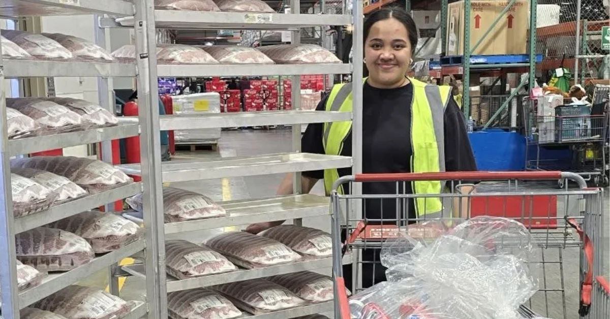
Surplus food from Costco North Lakes is being turned into meals for people experiencing homelessness and financial hardship, with much of the donated meat extending beyond Nourish Street Inc’s own programs to other community meal services.


The North Lakes store has supported Nourish Street for more than a year by donating meat and other food. Meat approaching its use-by date is frozen at the store before being collected by the charity and transferred to its own freezers.

From there, donated meat is sent to licensed kitchens that prepare meals for Nourish Street’s programs.

How Costco North Lakes Donations Travel Further

Nourish Street prepares about 850 meals each week but uses only around 30 per cent of the meat it receives. The remainder is passed to other community groups, including organisations operating soup kitchens and other meal programs.

That redistribution allows food collected from one North Lakes store to continue through a broader community network rather than remaining within a single charity.

A recent donation from Costco North Lakes included a large supply of mince as well as cans for recycling. Nourish Street said the mince would be sent to licensed kitchens preparing meals for people experiencing homelessness.

Additional meals prepared from the donation can be frozen and passed to other charities and community organisations. Nourish Street estimated that the mince donation would ultimately help feed thousands of people across the wider community.

Ongoing Donations Support Weekly Meals

The charity has also acknowledged other bulk meat donations from the store, describing the support as helping keep hundreds of people fed each week while saving usable food from going to waste.

The donations have drawn positive comments from community members, with people thanking Costco North Lakes and recognising both the store’s contribution and Nourish Street’s work.

The cans supplied with the recent mince donation are also being recycled, providing another form of support for the charity.

Nourish Street’s Wider Community Work

Nourish Street began as a self-funded family effort led by Beau Haywood, Jenny Ignacio and Haywood’s sons Kane, Zion and Isaac before developing into a registered charity supported by volunteers.

Its work includes hot meals, groceries, tents and other essential supplies for people sleeping rough. The organisation also works with other frontline groups to share resources and help people in crisis access services and support.


Nourish Street says it assists more than 100 people five days a week across Moreton Bay and Pine Rivers. Its stated service areas also extend to West End and Brisbane CBD.

Published 24-August-2026

Wildlife Crossings Built Into Major Bruce Highway Plans North of North Lakes

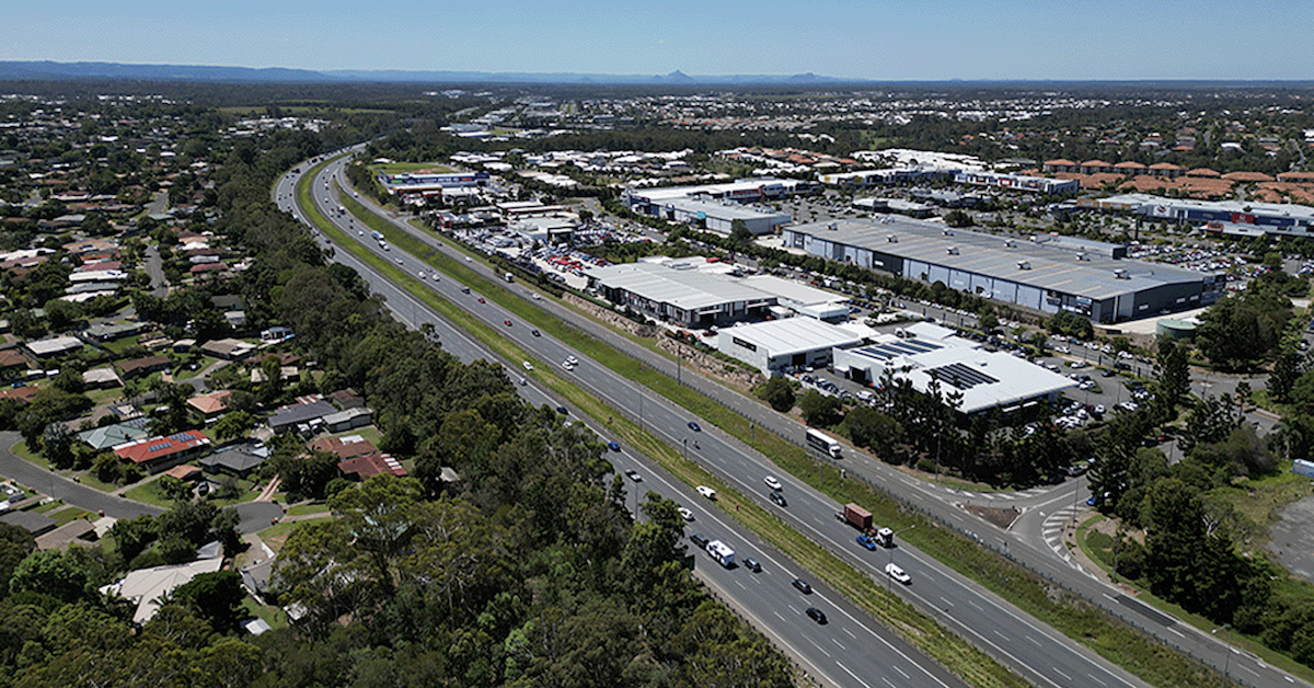
Underground wildlife crossings have been included in plans for a major expansion of the Bruce Highway north of North Lakes, putting fauna movement into the design of one of Moreton Bay’s busiest transport corridors.


The Department of Transport and Main Roads’ preferred plan covers 18 kilometres of the Bruce Highway between Anzac Avenue at North Lakes and Caboolture-Bribie Island Road.

The project is primarily about carrying more traffic. It would add a fourth lane in each direction between Anzac Avenue and Uhlmann Road, while further north, new collector-distributor roads would separate local traffic from vehicles continuing along the highway.

But the plans also make room for wildlife.

Wildlife Movement Included in the Design

TMR’s fly-through of the preferred design identifies an underground fauna crossing spanning the highway south of the northbound and southbound service centres in the Burpengary-Morayfield area.

Another fauna crossing is shown further north.

The locations are well north of Anzac Avenue and are not the wildlife crossing previously sought near North Lakes. They do, however, show fauna movement being factored into plans for a highway expected to become substantially bigger.

It is also not happening in isolation.

South of North Lakes, the $948 million Bruce Highway upgrade around the Gateway Motorway interchange includes fauna fencing and a fauna underpass running east-west beneath the Gateway Motorway, Bruce Highway and Gympie Arterial Road interchange.

The next stage, extending north across the Pine River towards Dohles Rocks Road, includes another fauna underpass on the northern side of the river bridges.

Together, the projects put several wildlife connections into plans for the motorway and highway corridor running towards North Lakes.

A Corridor Carrying 160,000 Vehicles a Day

The scale of the transport challenge helps explain the size of the works being planned.

TMR says about 160,000 vehicles travel between the Moreton Bay Region and north Brisbane each day on the Gateway Motorway, Bruce Highway and Gympie Arterial Road. Traffic levels across that wider corridor are expected to increase by about 50 per cent by 2041.

North of Anzac Avenue, the preferred 18-kilometre Bruce Highway upgrade would also overhaul the Uhlmann Road, Buchanan Road and Caboolture-Bribie Island Road interchanges. New highway bridges are proposed over Burpengary Creek and the Caboolture River.

The preferred option was released for community consultation in July 2025. Consultation closed in September, with TMR saying the feedback is being reviewed and will be considered in future project phases.

Crossings Are Planned, Not Yet Built

There is an important distinction between what appears on the plans and what motorists — or wildlife — will eventually see.

The Anzac Avenue-to-Caboolture-Bribie Island Road upgrade remains in planning. The preferred design is subject to further project development, and construction funding would still need to be secured.

Further south, work is more advanced. Detailed design is underway on the Gateway to Bruce Upgrade, which incorporates the $948 million Bruce Highway Stage 1 project. Construction is expected to begin in late 2026, subject to environmental approvals.

The adjoining Pine River-to-Dohles Rocks Road stage is also in detailed design. The Australian and Queensland governments have committed $30 million towards its design, but further funding is required for construction.

For North Lakes and surrounding suburbs, the plans offer an early look at how one of the region’s biggest transport corridors could change as Moreton Bay continues to grow.


More lanes and bigger interchanges dominate the engineering. But wildlife movement is now on the plans too.

Published 20-August-2026

Private Six-Court Tennis Academy Proposed In Dakabin 

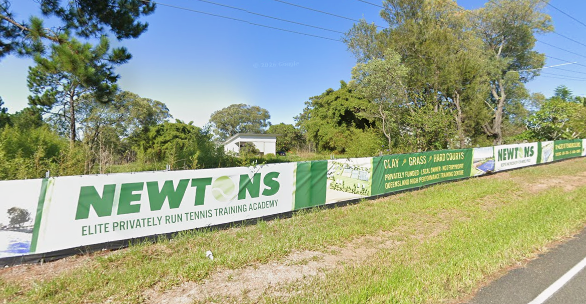
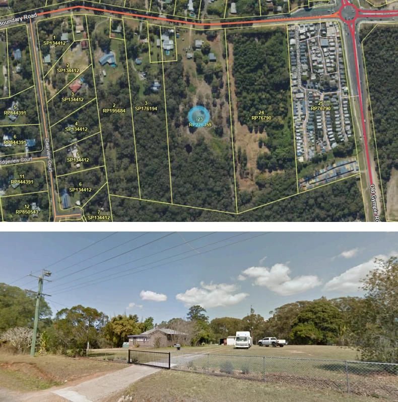
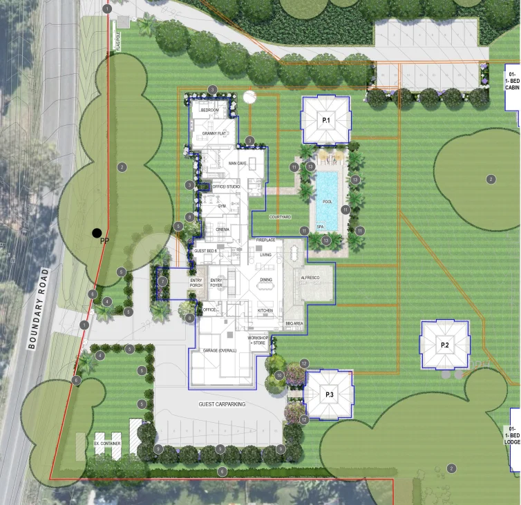
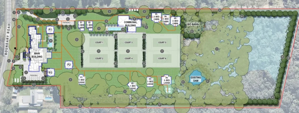
Plans for a private six-court Dakabin tennis academy have been lodged for a 4.54-hectare Boundary Road property, with the proposed facility designed for a limited group of junior and professional athletes rather than public court use.


Newtons High Performance Tennis Academy is proposed for 328 Boundary Road under development application DA/2026/3420, which was lodged on 6 July 2026 and remains under assessment by the authorities.

The application describes the academy as a not-for-profit elite athlete development facility focused on coaching and structured high-performance training. It would accommodate up to 16 junior athletes, five professional tour athletes and three coaches.

Aerial view of Boundary Road development site
Photo Credit: DA/2026/3420

Dakabin Tennis Academy Would Be Private

The proposed academy would not operate as a public tennis centre or commercial sporting complex. Public court hire, social tennis, tournaments, spectator events and general recreational use would not be offered.

Six courts with varied playing surfaces are proposed, with the planning report describing the surfaces as representative of those used in professional tournaments. A communal building would provide space for strength and conditioning activities.

Cabins would provide short-term accommodation for athletes and other personnel associated with the academy. The planning report states that these cabins would be restricted to people affiliated with the on-site operation and would not be used as tourist or holiday accommodation.

A dwelling house and secondary dwelling are also proposed, together with parking, a swimming pool, outdoor pavilions and outbuildings for maintenance and sporting equipment.

The residential elements would be positioned towards the Boundary Road frontage, with the tennis facilities behind them. The planning report says the development has been arranged within open and previously disturbed portions of the property and that the tennis infrastructure would not be visible from Boundary Road.

Proposed tennis courts within Dakabin academy plans
Photo Credit: DA/2026/3420

Rural Residential Site Faces Impact Assessment

The 45,400-square-metre property has about 102 metres of frontage to Boundary Road and sits within the Rural Residential Zone.

Approval is being sought for a Material Change of Use covering a dwelling house and secondary dwelling, educational establishment, outdoor sport and recreation, and short-term accommodation.

The educational, short-term accommodation and outdoor sport and recreation components are Impact Assessable. The planning report identifies a 15-business-day public notification period as part of the development assessment process.

The proposed dwelling would also exceed the site’s mapped maximum building height of 8.5 metres. The applicant’s planning assessment submits that the dwelling can remain compatible with the area because of its proposed scale, setbacks and position on the large allotment.

Boundary Road property proposed for tennis academy
Photo Credit: DA/2026/3420

Koala Habitat And Other Site Constraints

Much of the property is mapped within a Koala Priority Area and Core Koala Habitat Area.

The applicant’s arboricultural assessment identifies 37 trees for removal but states that no native trees are proposed to be removed. It identifies trees proposed for removal within the mapped Core Koala Habitat Area as Pinus elliottii, an exotic species, and states that native trees and koala habitat trees within that area would be retained.

Flood and bushfire hazard mapping also affects parts of the property, with specialist assessments covering those matters. Other supporting material addresses stormwater, ecology, landscaping, arboriculture and wastewater.

The application also states that Tennis Queensland and Tennis Australia support the academy as an athlete-development pathway. Its planning material links the proposal to the lead-up to the Brisbane 2032 Olympic and Paralympic Games and the provision of specialised high-performance training environments.


An earlier application for the property, DA/2025/1009, was withdrawn before being accepted as properly made.

The current application is listed by council at the Information Request stage, which began on 4 August 2026 and has a due date of 19 August 2026.

Published 10-August-2026

Free Camping Site Opens at Wyllie Park in Petrie

A free camping site in Moreton Bay has opened at Wyllie Park in Petrie. For people who need somewhere to stay, it gives a no-cost option in a monitored public space.


The site sits within an existing overnight camping area. It has toilets and refuse facilities. City of Moreton Bay says it will also keep watch through CCTV and regular security patrols.

Council responds to pressure on parks

Mayor Peter Flannery said the site is not crisis accommodation or long-term housing. He said the State Government remains responsible for those services.

Still, he said Council has seen growing pressure on public parks and open spaces. That pressure has pushed Council to look for a practical response.

Photo Credit: GoogleMaps

Division 8 Councillor Jim Moloney said Council faced a difficult task. He said it does not run crisis accommodation. However, he said public parks have come under increasing pressure.

Cr Moloney said Wyllie Park offers a viable alternative to public parks. He also said it provides a free camping option for people who need it.

A place close to support

Council says the site is voluntary and no-cost. It also says the location keeps people close to support services.

That matters. For people living rough, distance can make every step harder. A site near help may offer a little more stability when life is already uncertain.

Encircle Community Services welcomed the move. CEO Barb Power OAM said the organisation has long pushed for better housing outcomes and stronger support for people experiencing homelessness.

She said demand for affordable and social housing continues to exceed supply. That shortage, she said, keeps pressure on already stretched local services.

Ms Power said the free camping site in Moreton Bay may give people a place with more stability. She also said it could help them stay near the support they need.

A local issue with no easy fix

Council has been clear that the site is not a solution to homelessness across Moreton Bay or South East Queensland. It has also called on the State Government to back not-for-profit groups that provide crisis accommodation across the region.

Even so, the move will be noticed across North Lakes and surrounding suburbs. Housing stress is not something that sits in the background anymore. It shows up in local conversations, in service demand, and in the strain on public spaces.

The new free camping site in Moreton Bay is a practical step, not a final answer. But in a climate like this, practical steps still count.


For now, Wyllie Park is open as a free camping option for people who need it.

Published 12-August-2026

Major Murrumba Downs Wastewater Upgrades To Support Moreton Bay’s Growing Communities

Communities surrounding North Lakes are among those set to benefit from a series of upgrades at Unitywater’s Murrumba Downs Wastewater Treatment Plant, as the utility expands infrastructure to support growth across Moreton Bay.


The treatment plant services approximately 187,000 homes and businesses in Dakabin, Griffin, Kallangur, Mango Hill and Murrumba Downs, as well as Bray Park, Joyner, Lawnton and Strathpine. It processes around 25 megalitres of wastewater each day—the equivalent of about 5.5 million toilet flushes.

The upgrades are part of Unitywater’s $500 million renewals and replacements program, which is aimed at strengthening water and wastewater infrastructure throughout its service region.

Unitywater Executive Manager Sustainable Infrastructure Solutions Mike Basterfield said the works included a range of improvements designed to support the plant’s ongoing operation.

The project involves refurbishing the plant’s bioreactor, replacing aeration diffusers that supply oxygen to microorganisms used in the treatment process, upgrading a cloth media filter tank and constructing a new aeration tank to improve biological treatment.

Photo Credit: Supplied

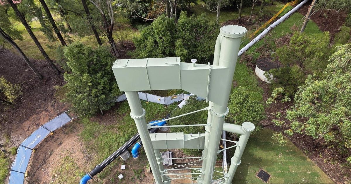
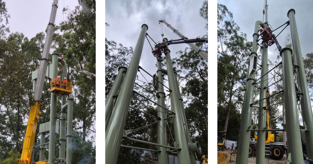
Upstream of the treatment plant, crews have also installed a 16-metre-high barometric loop—a distinctive U-shaped structure that uses gravity and atmospheric pressure to maintain efficient wastewater flow.

According to Unitywater, the new structure will increase pumping efficiency while helping reduce odour and the risk of blockages in the wastewater network.

Mr Basterfield said the crane lift also drew the attention of children from nearby Green Leaves Early Learning Centre, who later visited the site dressed in miniature high-visibility safety vests.


The barometric loop was installed by Dormway earlier this year, while Downer is delivering the remaining works. The full program is expected to be completed by November 2026.

Published 1-Aug-2026

Mt Maria College Reveals New Crest Ahead of 2027 Name Change

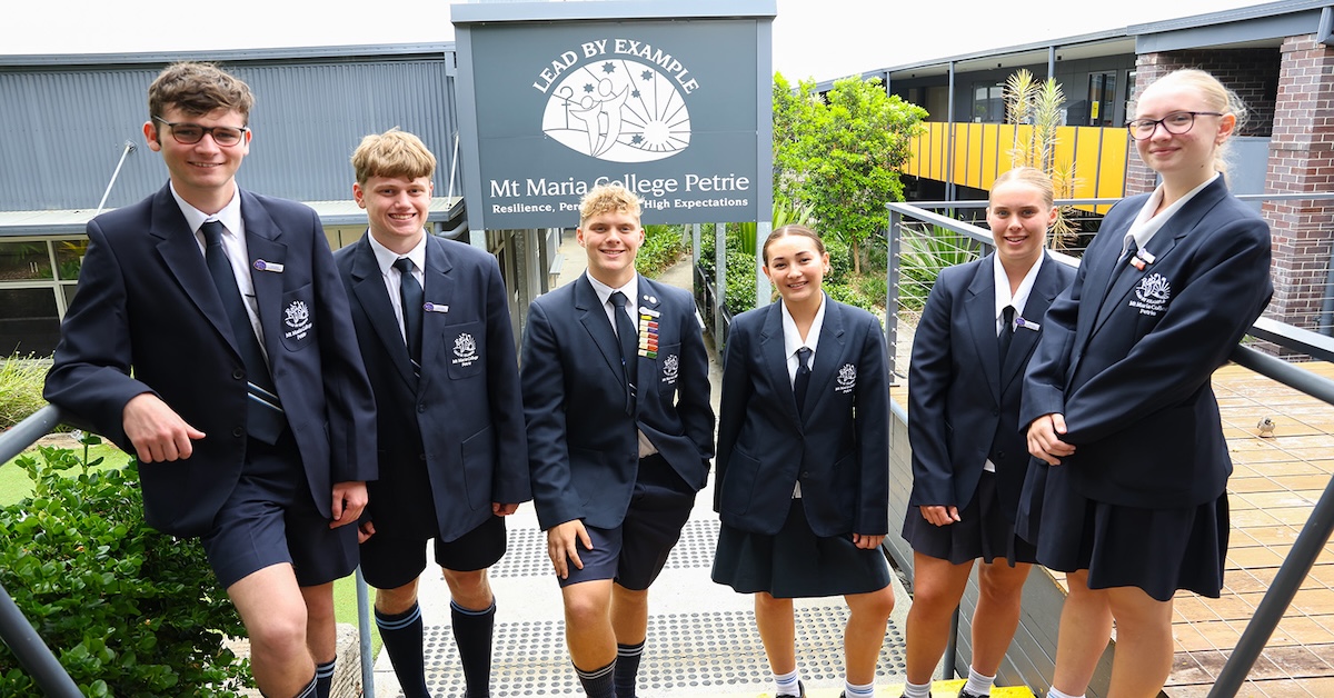
Mt Maria College has revealed the crest that will represent the Petrie school when it becomes St Marcellin Catholic College. The new identity marks the next stage of a transition announced by the college, following two years of consultation with students, parents and staff.


The college announced in April that it will formally adopt the St Marcellin Catholic College name in January 2027. Planning will continue throughout the remainder of 2026. 

New signage, branding and uniforms will form part of the transition. The college previously said uniform changes would be phased in to avoid extra costs for families. It also indicated that the existing college colours would remain largely unchanged.

Principal Kerry Maher said the identity would support the college’s future direction while retaining values already established within the school community.

New name strengthens Marist identity

St Marcellin Catholic College will take its name from St Marcellin Champagnat, founder of the Marist Brothers. His approach to education centred on young people, faith, compassion and personal relationships, and those principles already shape its work with students.

Maher said the new name gives the school a clearer identity and expresses its Marist character more directly. She also linked the change to student growth, wellbeing and strong learning outcomes.

The school’s Marist values include family spirit, simplicity, presence, love of work and care for people who need support. Those values would play a greater role in shaping the school’s future. 

Crest links faith, heritage and place

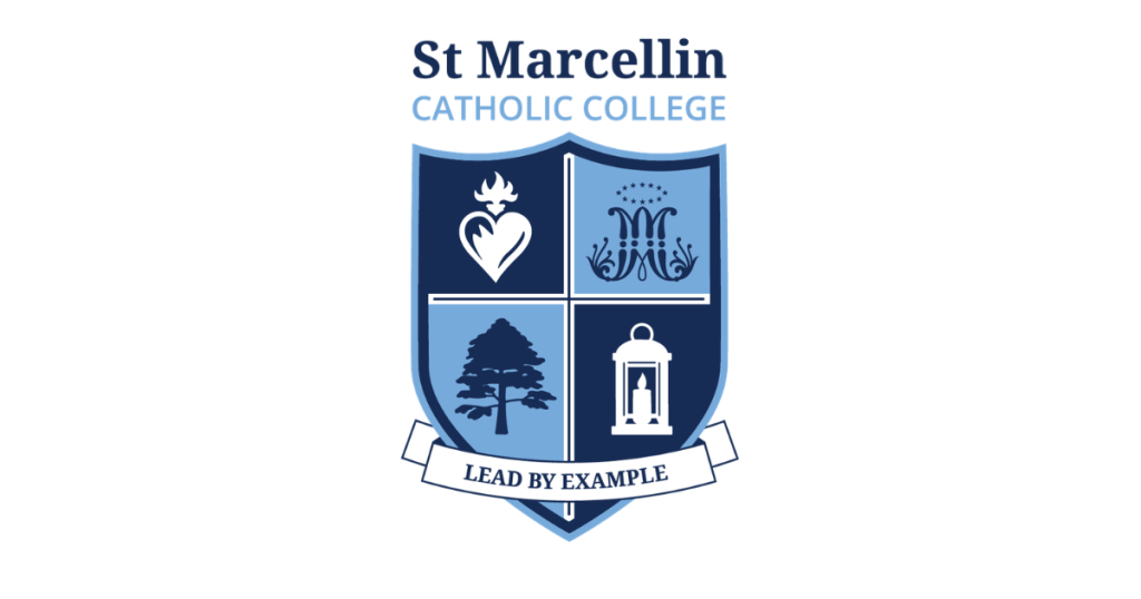
The new crest places a cross at the centre of the design, representing Jesus Christ and the school’s Catholic identity. A heart represents the Sacred Hearts of Jesus and Mary, while the Auspice Maria symbolises Mary’s protection. The emblem also reflects the college’s Marist identity.

Photo Credit: Supplied

An Indigenous Bunya Pine acknowledges the history and heritage of the local Gubbi Gubbi people. The symbol gives the crest a clear connection to the Petrie area.

A lantern represents the call for members of the school community to bring light to others through their actions.

The motto, “Lead by Example”, appears beneath the crest. It draws on 1 Timothy 4:12 and encourages students to show leadership through the way they speak, live and serve.

Mt Maria and Kolbe histories will remain

The transition will not erase the school’s earlier identities. The school will continue to recognise the history of Mt Maria College and the former Kolbe College. Both names form part of the college community’s history in Petrie.

During Catholic Education Week, the college shared material from Kolbe College’s foundation year with Brisbane Catholic Education. It also shared a 25-year celebration publication featuring the Kolbe College and Mt Maria College logos together.

Student programs set to continue

The college has also emphasised that its central work with students will remain unchanged. It will continue to offer academic and vocational pathways for different interests and post-school goals. These include university preparation, industry experience and mixed learning options.

Programs named by the college include the Scholars Program, Industry Recruits, STEM Innovators, Inquiry Learning and the Integrated Learning and Pathways Program.

Career education will continue across Years 7 to 12. Sport, instrumental music, student leadership and pastoral programs will also remain.

The school also plans to retain camps, retreats, work experience, excursions and industry visits. Arts opportunities include the college band, vocal group, dance troupe and the Luminaire Art Extension Program. Students will also continue to take part in representative sport and community service initiatives.

The school said its staff would keep focusing on knowing students individually and helping them build confidence, skills and purpose.


Consultation shaped the decision

Parents, students and staff took part in consultations during 2024 and 2025. According to the college, participants wanted continued improvement, a strong sense of purpose and an identity that would support students into the future. The feedback also showed support for high expectations in learning and a strong focus on student wellbeing.

Published 30-July-2026

Milly Brings Matilda’s Legacy To Petrie

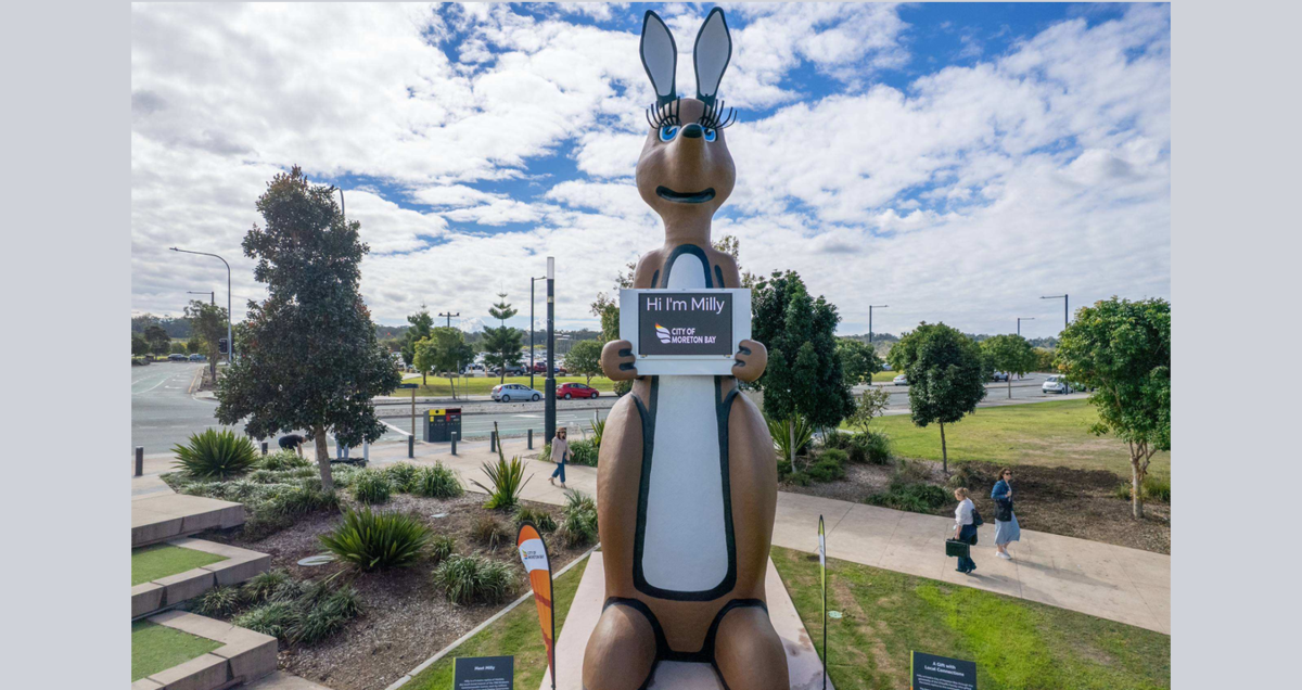
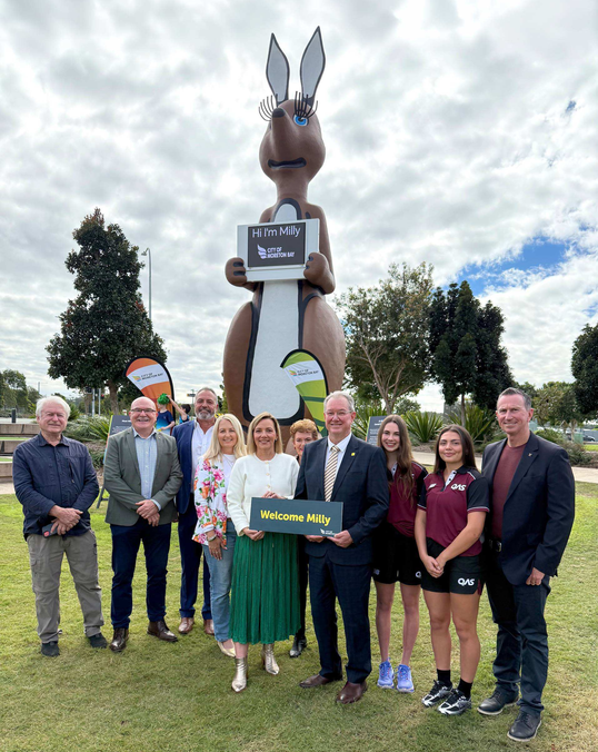
A nine-metre kangaroo has hopped into Petrie, with Milly now standing proudly at The Mill Water Park and Play Space as a new local landmark for City of Moreton Bay.


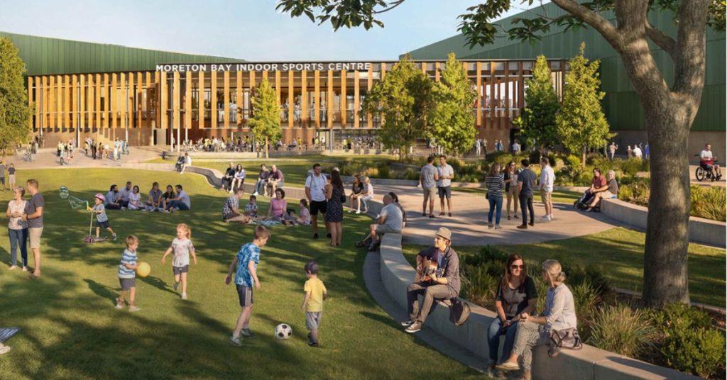
The giant replica of Matilda, the mascot of the 1982 Brisbane Commonwealth Games, has been named Milly in honour of the old Mill site, now known as Moreton Bay Central. The sculpture sits beside the future Moreton Bay Indoor Sports Centre, linking one of the city’s best-known family destinations with its sporting future.

Photo Credit: City of Moreton Bay

City of Moreton Bay Mayor Peter Flannery said Milly represents both the city’s history and its role in the road to Brisbane 2032.

“Forty-four years ago, Matilda announced Queensland to the world. Today, her spirit returns,” Mayor Flannery said.

“Milly will stand here as a proud, daily reminder of the role our City continues to play in shaping the Brisbane 2032 Olympic and Paralympic Games, and I hope she inspires the next generation of local athletes to set their sights on competing in 2032.”

A family gift with a second life

Milly was generously donated to the community by the O’Keeffe family, giving the much-loved sculpture a new home in Moreton Bay.

For creator David Joffe of Natureworks, the project was about preserving something familiar and giving it another chapter in the public eye.

“We didn’t just build a giant kangaroo — we helped save an Australian icon and give it a new life for future generations,” Mr Joffe said.

“Rather than disappearing into storage or being lost forever, she’s now part of a community Playground where families and children can enjoy her every day.”

Artist impression of the new Moreton Bay Indoor Sports Centre

Mr Joffe said the project was “a fantastic example of recycling in the best possible way”, with the sculpture now able to be enjoyed rather than forgotten.

A local icon with a story to tell

1982 Brisbane Commonwealth Games gold medallist Robert de Castella also welcomed Milly’s arrival, saying Matilda was unforgettable for many Australians.

Matilda at the 1982 Commonwealth Games opening ceremony. Photo Credit: NFSA

“You could not miss her. She was the face of those Games, and for a lot of us she is the first thing we picture when we think back to 1982,” Mr de Castella said.

“What those Games did was show a generation of Queensland kids that the world would come to us, and that we belonged on that stage.”

He said the sculpture’s new home was especially meaningful with the Brisbane 2032 Games approaching.


“There will be young athletes running around this park today who could be competing in 2032, so this is a really exciting day.”

For Moreton Bay families, Milly adds a touch of nostalgia, a strong local talking point, and a playful landmark for children visiting one of the city’s favourite community spaces.

Published 24-July-2026

Narangba Residents Invited To Comment On Precinct Plans 

Narangba residents will be able to comment on proposed changes to the Narangba Innovation Precinct, including future industrial development and a proposed air quality assessment policy.


Public consultation on Major Planning Scheme Amendment No. 5 – Narangba Innovation Precinct (East) will run from 27 July to 24 August 2026.

The proposal applies to the industrial precinct on the eastern side of the Bruce Highway. Residents can also review and comment on the proposed Planning Scheme Policy – Air Quality Impact Assessment during the same period.

Community Feedback Opens In Narangba

The amendment and its supporting documents will be available through the Your Say Moreton Bay website, where feedback can be submitted before consultation closes.

The proposal seeks to establish a long-term planning position for Special and High Impact Industry within a designated section of the existing precinct.

It would not expand the Narangba Innovation Precinct’s overall footprint. Instead, the amendment would provide planning provisions for industrial businesses already operating in the designated area and for future development applications.

City of Moreton Bay says the proposal could support nearly 600 additional Special and High Impact Industry jobs and contribute $129 million to the local economy.

More than 3,000 jobs in Special and High Impact Industry are already located within the precinct.

Map showing the Narangba precinct study area
Photo Credit: City of Moreton Bay

Cumulative Impacts Form Part Of Assessment

Future development would be considered through a whole-of-precinct assessment approach.

This would require potential impacts from a proposed development to be considered alongside existing emissions from across the precinct, rather than assessing each application in isolation.

Applicants would need to demonstrate that their development would not cause adverse effects in surrounding areas.The proposed air quality policy would provide city-wide guidance for businesses conducting air quality assessments for new developments. It would also give specific guidance on assessing cumulative air emissions within or next to the Narangba precinct.

Aerial view of Narangba industrial precinct
Photo Credit: City of Moreton Bay

Investigations Inform Precinct Proposal

The planning amendment follows environmental health investigations carried out between 2020 and 2024.

Independent consultants examined air quality, noise, human health, fire risks and other environmental hazards associated with allowable combined impacts from Special and High Impact Industry in the eastern precinct.

Economic investigations also considered the industries’ contribution to employment, productivity and the local economy.

The work followed the introduction of a Temporary Local Planning Instrument in July 2020. The instrument established interim planning rules while a longer-term position was developed for industrial activity and the protection of nearby residential areas.

The Temporary Local Planning Instrument has been extended for a further 12 months, allowing those interim rules to remain while consultation and the planning amendment process are completed.


Any adoption of the amendment will remain subject to the outcome of consultation and ministerial approval. Feedback can be submitted through the Your Say Moreton Bay website from 27 July to 24 August.

Published 21-July-2026