



Out Past the Last Streetlight: A Svalbard Wilderness Camp

By Jack Mercer – Rabbit Hole Fisherman

Across the fjord from Longyearbyen, a summer camp offers kayaking, glacier walking and a turn on polar-bear watch. Getting into the Arctic means learning how to live there for a few days, including when to change your plans.

In This Story

There is a small catch in the promise of sleeping under Svalbard’s midnight sun. Someone has to stay awake.

On the four-day Ymerbukta wilderness camp offered by Svalbard Wildlife Expeditions, guests share polar-bear watch as well as the cooking and washing up. The company asks prospective travellers to consider whether they are comfortable getting out of bed at three in the morning. It is a useful detail to encounter before booking. The photographs may have sold you the glacier. The roster needs your attention too.

For an Australian accustomed to checking a campsite for ants, this is a considerable adjustment. There is also something appealing about a holiday that gives you a job. You have to learn enough about the place to be useful to the people beside you.

Longyearbyen, the base before the crossing

The journey begins in Longyearbyen, on Spitsbergen, the largest island in Norway’s Svalbard archipelago. At about 78 degrees north, the town sits beside Adventfjord, with steep mountains around it. It has restaurants, shops and a cultural life, along with the practical services of a working community. Visit Svalbard traces its beginnings to coal mining, and records that Mine 7, the last Norwegian coal mine near town, operated until summer 2025.

It is tempting to treat somewhere this far north as a stage set for your arrival. People have groceries to buy here. The town is also where an expedition can gather its equipment and make the necessary arrangements before heading out. Appreciating both uses helps keep the traveller’s enthusiasm in proportion.

Across Isfjorden to Ymerbukta

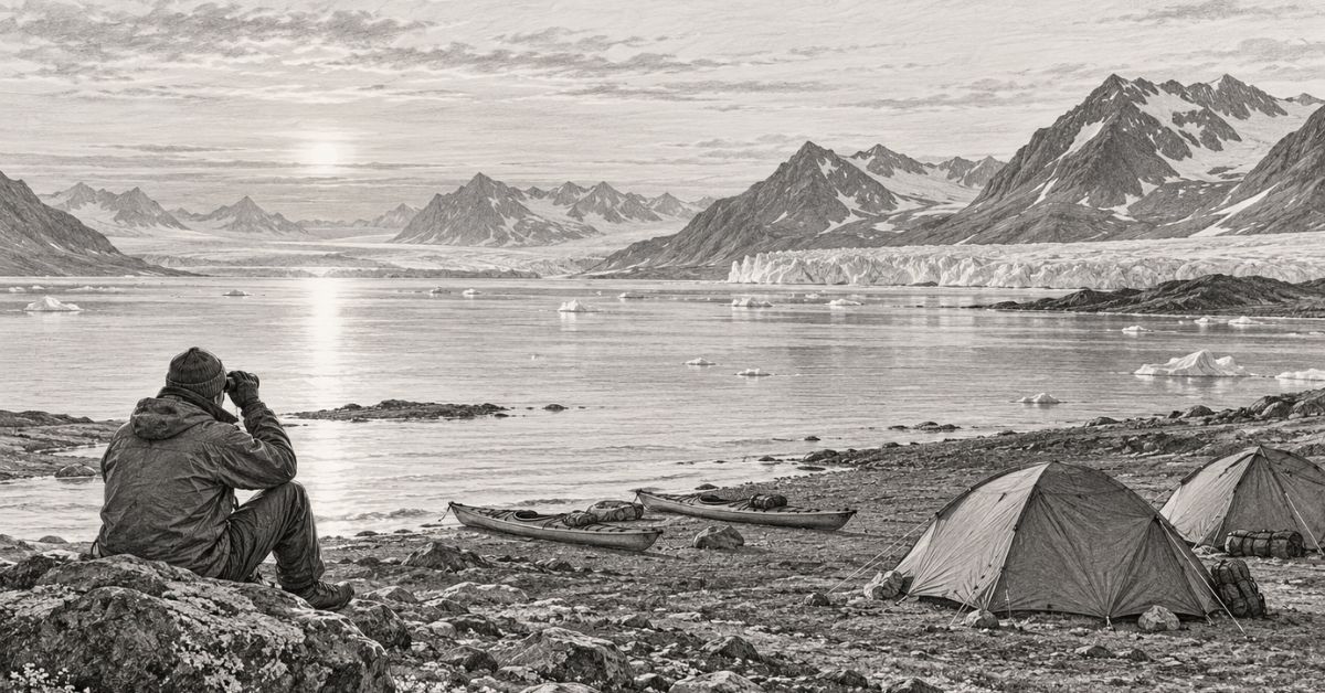
Beyond it lies an awkward geography for anyone who likes to hire a car and improvise the rest. The Ymerbukta trip crosses Isfjorden by boat. The operator describes a crossing of about two hours, followed by setting up camp and a first outing in kayaks. Esmarkbreen, the glacier, is part of the reason to come. Later, there is a guided walk on the ice and scope for a longer mountain hike, with Värmlandsryggen ridge among the possibilities.

Four days gives the visit enough time to develop beyond arrival and departure. It also leaves some room for the weather to have its say. A fixed camp becomes a base from which to explore, rather than another place to pack up each morning.

A guide’s view of the place

One guide who has explained the attraction is Nanna, identified by her first name in an October 2020 interview reproduced in the company’s expedition diary. She had first visited Svalbard in 2014 and studied outdoor recreation. Asked about her favourite trips, she included the Ymerbukta camp, where guests could kayak at a safe distance from the glacier, walk on the ice and hike. She also liked a simpler walk, Blomsterdalshøgda.

That second choice is reassuring. A good day outdoors need not involve the hardest thing on the booking page.

In the same interview, Nanna advised guests to read the trip description and ask questions, especially about fitness and equipment. Her enthusiasm came with an expectation that people would choose something they could manage. It is advice that can sound obvious until the view in the photograph begins doing your thinking for you.

Fitness, ground and camp routines

The four-day camp is advertised as requiring good fitness, although previous kayaking or glacier-walking experience is not necessary. Training is provided. Visit Svalbard’s listing describes rough ground, including sand and rocks, and says guests participate in daily camp routines.

Being a beginner and being unprepared are quite different circumstances. You can arrive willing to learn a new skill while already knowing how your knees behave on uneven ground. Honest questions before departure are considerably easier than a discovery halfway through a hike.

Light, weather and clothing

Summer helps with the light. Svalbard’s bright season makes boat journeys and walking possible in a setting many people associate almost entirely with snow. The midnight sun lasts into late August. Later in that month and through September, the evenings begin to darken and the plants turn towards their brief autumn. Migratory birds give the summer a busier animal life than winter, while small plants add colour to the tundra.

There is a reason to spend time looking down as well as across the bay. A mountain can fill the background of every photograph and still leave you knowing very little about the ground you stood on to take it. Staying in one area gives you another chance to notice what you hurried past yesterday.

The daylight also needs separating from the temperature. Visit Svalbard’s clothing guidance gives an average of 3 to 7 degrees Celsius for the summer months, which it defines there as mid-May to September. It recommends warm layers, windproof clothing, a hat and mittens. Melting snow and ice raise rivers and streams, adding wet crossings to the practical questions a walking party may face.

An Australian summer wardrobe will require substantial revision.

Packing, boots and cold-water gear

Packing for a camp also takes a little more conversation than packing for a hotel. Establish what the operator supplies, what you carry yourself and which items must fit properly before departure. Boots deserve particular attention. There is limited entertainment value in discovering that yours rub, even with a glacier available to distract you.

Cold-water kayaking introduces its own equipment. The kayak clothing supplied for this camp includes a drysuit and life jacket. Glacier equipment is included too. These are things to learn to use, with guidance, before concentrating on the scenery.

A traveller’s account from elsewhere around Longyearbyen gives a useful glimpse of how that instruction changes a day. Writing for Earth Trekkers about a June 2018 outing across Adventfjord and up Hiorthfjellet, Julie Rivenbark described preparations involving drysuits and dry bags. Her guide, Nanna, set a 2.30 pm turnaround time for the mountain. Snowy conditions could also have ended the ascent early. This was a separate day trip, rather than the Ymerbukta camp.

The detail worth carrying across is the deadline. In continuous daylight, there is still a time to turn around. A guide has a whole journey to manage, including the return, while a guest can become rather attached to the next ridge.

It takes some discipline to accept a limit while you still feel capable of continuing. That is part of what you are buying when you join a guided expedition. You get another person’s judgement, formed with more information than your own desire to reach the top.

Guides, glaciers and decisions

Svalbard Wildlife Expeditions says its guides assess where and how to travel on glaciers, and check weather, sea and ice conditions before travelling across fjords. Its safety guidance also stresses keeping the party together and carrying polar-bear protection.

On the glacier, the equipment and the decisions belong together. Crampons and a harness cannot tell you which route is suitable that day. A visitor can enjoy learning how to move on ice without mistaking a few hours of instruction for the ability to organise the next outing alone.

Polar-bear country

Back at camp, the watch makes the same point in a more stationary way. The Norwegian Polar Institute warns that bears can be encountered in summer on beaches, in valleys and on glaciers. Its advice on camps includes choosing places with good visibility and avoiding locations where bears have recently been seen. It also explains that food smells can attract bears, making storage and waste handling part of camp safety.

This gives the washing up a significance it rarely enjoys at home. Camp routines deserve attention even when the weather is lovely and everyone would prefer to keep looking at the water. A guided trip lets you take part within an organised system, with the briefing defining your responsibilities.

The rules protect the animal as well. Changes introduced on 1 January 2025 set a minimum distance of 300 metres from polar bears, increasing to 500 metres from 1 March to 30 June. The Governor’s guidance also prohibits unnecessarily disturbing, attracting or pursuing them. For someone walking in the field who discovers a bear at close range, the requirement is to retreat. The guidance specifies exceptions to that retreat obligation for occupied facilities, including tents.

Changing plans, staying flexible

A bear in the area may mean a change of plan. Visit Svalbard’s camp listing explicitly allows for returning to Longyearbyen and doing day trips instead. Weather, ice and the group’s capabilities can alter the itinerary too.

Read that condition before paying. If your measure of success depends on completing every advertised activity, you have given the guide a difficult audience. Returning without the expected photograph may be the result of a sensible decision made early enough.

There are arrangements behind the camp that guests will never see. Commercial tourist camping requires permission from the Governor, with applications due at least four weeks beforehand. The Governor’s current travel guidance requires an organised, vigilant polar-bear guard at camps subject to application. It also explains that travel requirements depend on the activity and the area.

The regulatory picture is developing. Field Operation Safety Regulations took effect on 1 January 2026. The Governor says the requirement for tourist businesses and field operations to use approved Svalbard guides outside inhabited areas starts on 1 July 2027. The regulations also address rescue-cost insurance. Anyone planning a future trip should ask the operator how the rules applicable to their departure are being met.

That is a reasonable booking question. So are questions about equipment, the demands of the walking and what happens if conditions prevent the camp from operating. Clear answers make it easier to arrive with realistic expectations.

Leave no trace, even here

There are smaller obligations once ashore. Visit Svalbard asks travellers to leave flowers unpicked, avoid disturbing wildlife and leave no lasting signs of their stay. The Governor’s travel guidance explains that traces of human activity from before 1946 are automatically protected, with further protections for graves and certain remains. Old objects belong where they are found.

An apparently empty place can contain quite a lot that a visitor should leave alone. Looking closely becomes a more satisfying occupation when it does not end with putting something in your pocket.

The Arctic is changing

Nor is the ice a permanent backdrop. Copernicus identifies Svalbard as one of the fastest-warming places on Earth, reporting warming of around 1.5 to 2 degrees Celsius per decade over the past 30 years in its European State of the Climate 2025 material. A visit offers a chance to learn about a changing environment, although arriving there is hardly a contribution to fixing it.

For now, the practical attraction of Ymerbukta remains the time it allows. You can spend several days in a small area, learn unfamiliar equipment and become better company in a camp. There is room for a walk to occupy more of your attention than arranging the photograph afterwards.

If a turn on watch is part of your night, the guide will explain what you need to do. Then the rest of the group can sleep. You have warm clothing, a clear responsibility and a stretch of Arctic daylight to pay attention to.

The River That Refused to Become a Dam: Rafting Tasmania’s Franklin River

By Jack Mercer – Rabbit Hole Fisherman

A rafting expedition down Tasmania’s Franklin River means days of white water, rainforest camps and carrying equipment around rapids too dangerous to run. The journey remains possible because Australians fought to keep the river flowing.

In This Story

The paddle is only part of the job.

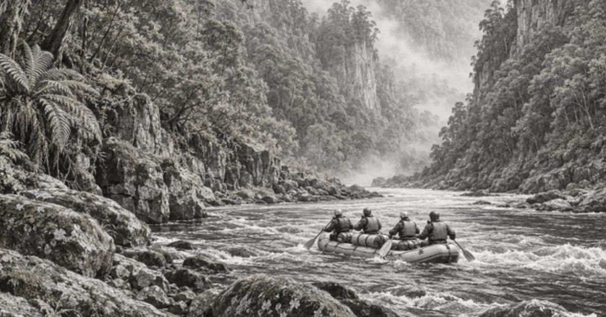
On Tasmania’s Franklin River, there are places where the sensible way downstream involves getting out of the raft. Food and camping equipment must be moved past an obstacle. The boat needs getting through too. A stretch of white water that looks magnificent in a photograph can turn out to be somewhere you spend quite a while carrying things.

That work belongs in the picture. The Franklin offers deep gorges and rainforest, but travelling through it asks for more than an appetite for scenery. Tasmania Parks and Wildlife Service describes it as one of the state’s most remote and committing rivers. Water levels can change quickly, and hazards include log jams that force paddlers to go around them. Experienced paddlers or a qualified, experienced guide are needed.

For people joining a guided trip, the attraction is partly that sustained involvement. You help move the expedition. Decisions about water and weather have consequences for the whole group, whose sleeping bags and dinner travel in the boats with them.

There is a famous history here, of protests and a dam that was never built. Yet the river has a much more immediate way of holding your attention. Before anyone can think about the next campsite, they have to get there.

A river with a timetable of its own

The usual full-river expedition begins on the Collingwood River, reached from the Lyell Highway, and follows it into the Franklin. Downstream lies the Gordon River, where onward transport carries rafters towards the west-coast town of Strahan. The International Rafting Federation describes a typical expedition as taking eight to ten days.

Those days matter. An afternoon’s activity can fit around the rest of a holiday. A week or more on a river begins to organise the holiday around itself. The gear you brought is the gear available. Another layer of clothing has to be in a bag, rather than back in a hotel room.

Water by Nature Tasmania offers full-river trips of seven or eight days, with longer versions incorporating a walk towards Frenchmans Cap. Its full-river description puts the navigable journey at around 110 kilometres and warns that low water and flood conditions can occur within days of each other. Duration and route are expedition arrangements, rather than a promise about what the water will do.

It would be easy to assume that less water means an easier journey. The operator’s seasonal guidance complicates that assumption. Lower levels can mean extra portaging and harder paddling, making a dry period physically demanding. Rain changes the problems again.

A map shows where the river goes. It cannot tell you how much carrying a particular week will require.

The human judgement behind those decisions is part of the adventure. A guide has to assess the passage available today, with this group and this load. An excellent memory of a rapid is useful; it still needs checking against the water actually running through it.

What the guide expects

In a published interview with Tasmanian Expeditions, rafting guide Abigail Nimui gives a practical account of the passenger’s role. She says participants need moderate fitness and should expect to scramble over uneven or slippery ground, help carry equipment and take part in camp work. Previous paddling experience is not required for that company’s guided trip, but contributing to the paddling is.

Nimui also explains that portaging involves getting people, boats and equipment safely below rapids that cannot be run. The arrangements vary with the water level. Her interview is a useful corrective to the idea that booking a guide makes the passenger’s job entirely passive.

It sounds like a fair exchange. You bring enough fitness to help; the guides bring the judgement that gives the effort a purpose. Someone who can tell you when to stop paddling may prove considerably more useful than someone urging you to paddle harder.

The Great Ravine gives that judgement plenty to do. Franklin River Rafting’s published itinerary describes several kilometres containing a concentrated sequence of major obstacles. Progress combines rafting with portaging and lining, the controlled movement of boats using ropes. The Churn is listed as a compulsory portage.

A long day can therefore cover a short distance. You may have worked hard without moving very far down the map, which is an awkward discovery for anyone accustomed to measuring progress by kilometres.

But a gorge is a place to travel through on its own terms. The safe route around one obstacle takes as long as it takes. Rushing to make the numbers look better would be a poor bargain.

Weather that changes the day’s work

The Franklin’s changing levels are more than a qualification tucked beneath an itinerary.

Travel writer Steve Madgwick documented a ten-day expedition in The Wilderness Society’s journal. He reported that the river rose two metres overnight on the third day, prompting a rest day. Persistent rain also prevented his group’s planned ascent of Frenchmans Cap. Those are observations from that particular journey, rather than a forecast for the next one.

They explain why a rest day can be a decision made for you. The expedition has to work with the river that arrived overnight.

The consequences reach into the less glamorous business of camping. Warmth and dry equipment become things to organise carefully. Water by Nature’s equipment list includes full-length wetsuits, personal dry bags, camping shelters, a satellite phone and an emergency beacon. The packing list reads rather differently from one for a riverside picnic.

The dry bag is an ordinary object worth paying attention to. It separates clothes and bedding from the water you are spending days travelling on. Closing it properly is a small task with a large audience later, principally yourself when you need something dry to wear.

A guided expedition makes these details manageable, but it cannot make them irrelevant. There is pleasure in that. The day has a set of practical jobs, and finishing them makes the evening better.

Under the trees

The rafting is only one reason to go. Along the banks is wet temperate rainforest, within a national park that also contains eucalypt forest and buttongrass moorland. The park protects Aboriginal sites recording occupation during the last ice age and remains of deep significance to Tasmanian Aboriginal people. Kutikina Cave is among the places returned to the Aboriginal community under the Aboriginal Lands Act 1995.

So the language of an untouched wilderness needs care. A visitor can be far from a road without being outside human history.

In ABC’s reporting on the Franklin campaign, palawa leader Michael Mansell explains the importance of Kutikina and his concerns about others using Aboriginal heritage to advance their own causes. His account centres ownership and connection to ancestors, even as he agrees that the place needed protection.

That perspective gives the journey a history deeper than the one many Australians first remember. The river’s public fame grew enormously in the early 1980s. Its cultural importance did not begin when it appeared on a protest sticker.

For rafters, evenings take place in riverside camps, sometimes beneath overhangs or on river flats. Water by Nature describes carrying the expedition’s shelter and food in the rafts, with limited comforts and no ordinary mobile reception along the remote journey.

The campsite is where the load becomes useful. Things carried awkwardly past a rapid become dinner, shelter and somewhere to sleep. Even a modest camp represents a satisfying amount of completed work.

There is no need to dress that up as an escape from civilisation. It is a few days spent living with equipment you helped get there, beside a river you are learning to pay attention to.

The dam downstream

The proposal that threatened the Franklin is sometimes described as though somebody planned to put a wall across the river itself. The main scheme was a dam on the Gordon River, downstream of its junction with the Franklin. Its reservoir would have backed up into the Franklin valley. [12]

The location explains the name Gordon-below-Franklin. It also explains why saving one river required stopping construction on another.

The National Museum of Australia dates the proposal to 1978. Cheap electricity and industrial development were arguments for proceeding. Conservationists opposed the flooding, and the dispute spread well beyond Tasmania. A blockade began in December 1982 and continued into March 1983. Bob Brown became one of its best-known figures.

It is tempting to read the outcome backwards, as if the protesters were performing a victory already arranged. They were trying to change a decision with machinery and government backing behind it. Opposition meant organising people, sustaining public interest and taking risks whose outcome remained uncertain.

After winning the March 1983 federal election, Bob Hawke’s government moved to protect the World Heritage area. The dispute reached the High Court. On 1 July 1983, the court’s decision upheld the Commonwealth’s intervention, stopping the project.

For a present-day rafting party, that history has a physical consequence: the gorge is still a gorge through which a river runs. The obstacle ahead still needs inspecting. A place that might have disappeared beneath a reservoir continues to make demands on anyone travelling through it.

There were livelihoods at stake in the dispute too. ABC’s retrospective includes the account of contractor Kevin Bailey, who had invested in machinery expecting work on the dam and faced an uncertain future when it was stopped. Acknowledging those consequences makes the history more honest. It does not lessen what was saved.

The river’s quieter work

Farther downstream, the pace changes. Franklin River Rafting describes wider, quieter water on the Lower Franklin and a transition towards limestone country. Its expedition continues into the Gordon and finishes the rafting at Sir John Falls before boat transport to Strahan.

The paddling still has to be done. A current that has supplied so much drama can also leave a crew with an ordinary stretch of effort. Quiet water is good for looking at the banks, although the raft has a destination as well.

Rock Island Bend carries particular associations with the conservation campaign through Peter Dombrovskis’s photograph. It is also somewhere on the route, reached by travelling through the country around it.

A famous image gives people a place to recognise. An expedition supplies the stretches either side, including the hours that would never make a poster. Those hours are much of the reason for going.

Something to carry out

Keeping the Franklin wild involves present-day behaviour as well as remembering the campaign. Parks and Wildlife identifies the national park as a fuel-stove-only area, prohibits fires and asks visitors to follow Leave No Trace principles.

For the expedition, that is another practical obligation. The equipment brought in has to come out, along with the waste produced during the trip. The memory of an evening under the trees does not need to leave anything behind on the bank.

Anyone considering the journey should check operator requirements against their fitness and camping experience. A guided Franklin trip can accommodate people new to rafting, but the shared physical work remains part of it. Conditions determine the day’s decisions.

Over several days, you learn where your gear is and how to contribute. You also learn when the person reading the water needs everyone to listen.

At the next compulsory portage, the boats and bags still need moving. The sleeping gear you will want tonight is sitting among them.

A Forest Inside the Mountain

By Jack Mercer – Rabbit Hole Fisherman

In central Vietnam, Sơn Đoòng contains enormous passages, an underground river and a forest beneath its broken roof. Reaching it takes days on foot, and depends on the local knowledge that brought explorers to its entrance.

The forest grows where the ceiling fell in.

In This Story

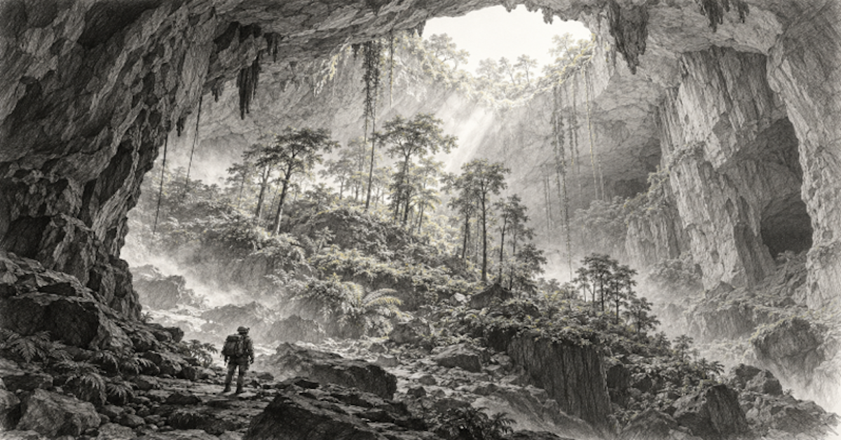
Deep inside Sơn Đoòng, in Vietnam’s Phong Nha-Kẻ Bàng National Park, daylight reaches through an opening in the mountain and trees rise towards it. Around this patch of green, the cave continues into darkness. The forest occupies a break in the roof of a much larger underground passage. Walking into the sunlight does not mean you have reached the way out.

That is an appealing complication. We tend to think of caves as enclosed places, with the world outside neatly separated from whatever lies within. Here the distinction becomes awkward. There is sky overhead, but a mountain around you. A forest belongs to the cave.

The place has a name, the Garden of Edam, bestowed by cavers whose appetite for a cheese joke survived a considerable amount of walking. Its trees owe their existence to sunlight entering through a collapsed section of roof, known as a doline. Some have slender trunks and grow unusually tall in their search for light.

The photographs invite a long stare. Then comes the question that gives this adventure its shape: how would you actually get there?

Long before there was an expedition to book, a Vietnamese forest worker named Hồ Khanh had to find the entrance twice.

The entrance he remembered

According to the discovery account published by expedition operator Oxalis, Khanh first encountered the opening in 1990. Caught in heavy rain while working in the forest, he sheltered beneath a cliff. From an opening came cold air and mist. There was a steep descent into the cave, and he lacked the equipment to investigate it. He went home.

It is easy, with the benefit of a famous photograph, to wonder why anyone would leave. But the photograph did not exist. Nor did the ropes, the survey or a guide explaining what lay below. Khanh had found a difficult opening in remote country while trying to make a living. Going down would have been a very different proposition from looking at it.

Years later, he told British caver Howard Limbert about the place. Finding it again proved difficult. Oxalis’s detailed account dates the successful return to 2008, after an unsuccessful search the previous year. Khanh recorded the route, and in 2009 led members of the British-Vietnamese expedition to the entrance.

There is something pleasingly stubborn about that interval. A cave large enough to become internationally famous could remain hard to locate. Its eventual appearance on maps depended on a man remembering what he had seen and going back through the forest to look.

Limbert’s own published account explains why the cavers were interested. They had explored nearby Hang En in 1994 and knew that its river disappeared into a valley where flood debris blocked access underground. Between the sinking water and its reappearance was a gap of roughly 10 kilometres in their map. Somewhere in the mountains, they expected a substantial continuation.

Khanh’s recollection gave them a way to reach it.

In April 2009, Peter MacNab was the first expedition member to enter Sơn Đoòng. Exploration and measurement followed, until a huge wall of calcite stopped progress. The team returned in 2010 with specialised climbing equipment; Gareth Sewell and Howard Clarke climbed the obstacle, opening the route towards an exit beyond it.

A year separates those two achievements. Even after the entrance had been found, the mountain still demanded another expedition.

A head torch has its limits

Sơn Đoòng is widely recognised as the world’s largest natural cave by volume. The published survey figure is 38.5 million cubic metres, with a length of nearly nine kilometres. The record concerns its enormous underground space; cave length is a different measurement.

Those numbers are accurate enough to repeat and difficult to picture. Cubic metres rarely improve a daydream. Put a person in the passage, however, and scale becomes much easier to understand: the person almost disappears.

Writer Mark Jenkins joined the 2010 expedition for National Geographic. His account describes a headlamp unable to reveal the full space above him, and the change when daylight through a roof collapse made the cave’s proportions visible. The experience required the light from outside to explain what the small lamp could not.

There is a practical limit to being impressed in the dark. You can know that a ceiling is far overhead without being able to see it. Distance becomes a matter for surveying instruments until daylight gives the eye something to work with.

Jenkins also recorded caver Jonathan Sims’s explanation of the first doline’s name, Watch Out for Dinosaurs. Sims and a companion had young sons and knew their dinosaurs; the vegetation and enormous opening recalled the setting of Arthur Conan Doyle’s The Lost World. The name came from a joke between explorers.

It has lasted rather well. A technical term can explain a roof collapse, but a warning about dinosaurs conveys something of the mood without asking the reader to inspect a geological diagram.

The actual explanation needs no prehistoric survivors. Rivers worked through the limestone along a fault, enlarging the passage over millions of years. Where the roof collapsed, sunlight entered. Oxalis’s geological account gives an estimated cave age of between two and five million years. The holes in the roof support vegetation and connect parts of the underground environment to the forest above.

The result rewards an ordinary kind of curiosity. Follow the water. Look at where the light reaches. Notice what can grow there.

The walk before the cave

For visitors, getting inside begins with walking through the national park. Oxalis’s current itinerary describes a six-day, five-night programme, including hotel nights before and after the field expedition. Its first trekking day covers about 14 kilometres, passing through Ban Doong and Hang En before reaching a forest campsite near Sơn Đoòng’s entrance. There are repeated stream crossings and steep sections.

Fourteen kilometres on a street would be a long walk. In this country, the distance comes with wet feet and attention to the ground. The attraction may be underground, but legs have work to do before anyone reaches it.

Ban Doong is home to a Bru-Vân Kiều community. Oxalis’s village history describes its establishment in 1992 after families moved from a settlement affected by flooding. The village occupies a place along the approach to the caves; for its residents, this valley is home.

That deserves a little more thought than the usual travel phrase about venturing into an empty wilderness. An expedition moves through country that other people know through daily life, work and family history. A visitor’s remoteness is a description of their own circumstances.

The descent into Sơn Đoòng uses safety equipment under supervision. Once inside, the route involves river crossings and movement over uneven rock. The current Sơn Đoòng expedition eventually takes visitors between the dolines and towards the Great Wall of Vietnam, the obstacle that halted the first explorers.

The route is organised, but the ground remains demanding. There is no useful way to hurry through a rough section just because the next view looks promising.

Limbert recalls that early exploration sometimes involved trips lasting 20 hours. His teams measured passages with laser instruments as they went. The first map emerged from lengthy, difficult work underground, carried out before there was an established visitor route.

Today’s traveller benefits from those hours without having to repeat them. There is still enough effort left to appreciate the difference.

Dinner beneath the mountain

A photograph of a tent inside an enormous cave makes camping look almost absurdly simple. Find the spectacular place, put up the tent, lie down.

The people carrying the equipment might offer a longer explanation.

Oxalis describes Khanh’s later role in expedition logistics, recruiting and organising porters and supporting visiting teams. The man who brought cavers to the entrance also helped make repeated journeys possible. His contribution continued after the discovery became news.

Meals and camps need people who can get supplies through the forest and over difficult ground. Every comfortable item a visitor uses has arrived by somebody’s effort. A dining table underground is worth admiring for reasons beyond its setting.

The operator’s campsite information describes sandy camping areas near the dolines, tents on raised platforms and places to eat. Current arrangements include a forest camp followed by two nights inside Sơn Đoòng. The equipment introduces some familiar routines into a setting that makes them look strange.

That familiarity has its own appeal. You can spend part of a day looking up at an opening in a mountain and still have to get yourself organised for bed. Clothes need changing. Tomorrow’s belongings need finding. The tent remains a tent, however extravagant the space around it.

The cave’s mist is another frequently photographed feature. The tourism department’s account describes clouds forming in the large passages and rising towards the dolines. These openings admit daylight, and the light varies with conditions and the time of year. A booked expedition cannot guarantee the exact shaft of sunshine in a photograph.

The forest is enough. Demanding that it perform on schedule would be a rather poor use of the trip.

Getting over the wall

Towards the end of the traverse lies the Great Wall of Vietnam, a calcite formation roughly 90 metres high. The original climbers needed drills, anchors and specialised techniques to get up it. Visitors follow a different route, using an installed ladder and safety ropes.

It helps to distinguish the formation’s full height from the vertical ladder section. The name can suggest a single sheer climb, whereas the visitor ascent combines a ladder with a longer, steep section above it. The route still asks for effort and attention.

Water also changes the approach. The passage beneath the wall can hold a lake, crossed by boat or raft; at lower levels, it becomes a muddy walk. The explorers named it Passchendaele after encountering the mud. Their names preserve some of the physical experience of working through the cave.

Much of an adventure happens at this scale, with a foot looking for purchase and a hand holding the next secure point. The great view can wait while someone works out how to cross the ground directly in front of them.

Beyond the wall, the cave continues towards an exit in the forest. What stopped one expedition became part of a later route through the mountain.

A place with a limit

Sơn Đoòng sits within a protected landscape recognised by UNESCO for its limestone karst and underground waterways. The wider World Heritage property now includes Hin Nam No National Park across the border in Laos. Its caves belong to a much larger geological story than the route visitors walk.

Access to Sơn Đoòng is restricted. Oxalis, the licensed expedition operator, states that visits are limited to 1,000 tourists a year and operate between January and August. Its conservation information describes environmental briefings and controls on visitor numbers.

The small number matters. A forest under a broken roof is easy to sell with a picture. Protecting the place involves decisions about how many people should enter and how they should behave once there.

For the visitor, accepting those limits seems a reasonable beginning. The cave was here long before anyone arranged an expedition calendar.

Khanh’s first encounter remains the detail worth returning to. A man sheltered from rain, noticed air and mist coming from an opening, and left because he could not safely descend. Years passed before he found it again.

Now people travel across the world to follow the route he remembered. Somewhere beneath the mountain, trees are still reaching towards the hole in its roof.